Omo Valley Tracks
The road ended at a river. This was not a metaphorical ending — the track simply arrived at a bank of red earth, dropped two metres to a riverbed of mixed sand and rock, continued across approximately 60 metres of flowing water of indeterminate depth, and climbed out the other side through a gap in the vegetation that may or may not have been a continuation of the road. Our guide — a man from Jinka named Dawit who had been navigating these tracks for eight years — got out of the vehicle, walked to the bank edge, studied the water for approximately thirty seconds, and said “possible.” He then removed his shoes, waded into the river up to his thighs, felt the bottom with his feet across the full crossing width, returned to the vehicle, and said “possible, but fast.” He meant the current, not the driving speed.
This was the third river crossing of the day. The first two had been dry — sandy beds that required momentum and deflated tires but no water assessment. This one was wet, flowing, and carrying enough current to push against Dawit’s legs as he waded. We crossed in low-range, first gear, at a steady 8 km/h, with the water reaching the bottom of the doors and the current nudging the vehicle sideways. The Land Cruiser held its line. On the far bank, Dawit got back in, put his shoes on, and pointed at the next section of track with the casual certainty of someone for whom this was a normal commute.
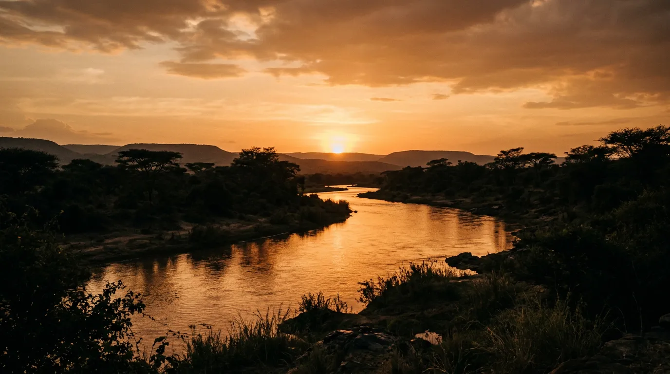
The lower Omo Valley is a region in Ethiopia’s deep southwest where the Omo River flows south toward Kenya’s Lake Turkana through a landscape of bush, savanna, and seasonal flood plains. It is one of the most culturally diverse regions in Africa — home to the Hamer, Mursi, Karo, Banna, Dassanech, and other ethnic groups whose languages, customs, and lifestyles differ significantly from one another and from the rest of Ethiopia. It is also one of the most remote regions accessible by vehicle, with tracks that are seasonal, unmarked, and subject to the Omo River’s annual cycle of flood and retreat.
We drove approximately 300 km of Omo Valley tracks over five days in November, based in the towns of Jinka and Turmi and venturing south toward the Kenya border and east to Mago National Park. This is what we found.
Route overview
The Omo Valley track network radiates from two small towns: Jinka (the regional capital of South Omo Zone) and Turmi (a smaller settlement approximately 140 km south). Between and around these towns, tracks lead to ethnic villages, river crossings, national parks, and market towns.
| Section | Distance | Terrain | Key features |
|---|---|---|---|
| Jinka to Key Afer | ~55 km | Paved then gravel | Descent from highlands, Banna and Ari territory |
| Key Afer to Turmi | ~65 km | Gravel, deteriorating | Hamer territory, dry riverbeds |
| Turmi to Omo River crossings | ~60 km | Laterite, sand, bush track | Karo and Dassanech territory, seasonal crossings |
| Turmi to Mago National Park approach | ~80 km | Rough track, bush | Dense bush, Mursi territory, park boundary |
| Turmi to Dimeka (market loop) | ~40 km | Gravel, corrugated | Thursday Hamer market, bull-jumping ceremony area |
None of these sections have reliable signage. Navigation is by GPS (OsmAnd has partial coverage), by asking locals (the guide translates), and by visual identification of track junctions that are distinguishable from the surrounding bush primarily by the fact that vehicle tires have compressed the dirt in two parallel lines. Several junctions required Dawit to get out, walk 50 metres in each direction, assess the tire tracks, and determine which route was current and which had been abandoned when the river rerouted last season.
Getting to the Omo Valley
From Addis Ababa
The Omo Valley is approximately 700 km south of Addis Ababa. The drive takes 10-14 hours on roads that transition from adequate highway to deteriorating tarmac to gravel. The route passes through Hosanna, Sodo, and Konso before descending to Jinka. Most travelers break the journey in Konso (approximately 600 km from Addis, 8-9 hours), which is a pleasant highland town and a UNESCO World Heritage Site for its terraced agriculture.
The alternative is flying to Jinka (Ethiopian Airlines operates intermittent service, subject to cancellation) or to Arba Minch (more reliable service, approximately 250 km from Jinka by road).
Jinka: the base
Jinka (5.9500° N, 36.5667° E) is a small town at approximately 1,500 metres elevation — cooler and more comfortable than the valley floor below. It has:
- Fuel: Two stations. Availability is not guaranteed. Fill completely and fill jerry cans. During our visit, one station was dry and the other had fuel but limited supply. We filled everything.
- Supplies: Basic supermarket, a few restaurants, a hardware store. Buy water, food, and any last equipment here.
- Accommodation: Several small hotels. Adequate. Not luxurious.
- Guides: Local guides can be arranged through hotels or the tourism office. A guide is effectively mandatory — not legally required for all areas, but practically essential for navigation and cultural mediation.
- Permits: The South Omo Zone requires a zone entry permit (arranged at the tourism office in Jinka, approximately 200 Birr) plus separate permits for specific areas and villages. The permits are straightforward but require patience and small-denomination Birr notes.
Vehicle and guide
We drove our own rented Land Cruiser with Dawit as guide and navigator. The cost for a guide in the Omo Valley is approximately 500-800 Birr per day ($15-25), which is the best-value expenditure on the entire trip. Without Dawit, we would have spent approximately 40 percent of our time lost, 30 percent stuck, and the remaining 30 percent at river crossings wondering whether the water was shallow enough to attempt.
Day 1: Jinka to Key Afer to Turmi
Descent to the valley
From Jinka, the road drops from 1,500 metres to approximately 800 metres over the first 55 km, passing through the territory of the Ari and Banna ethnic groups. The first 20 km is paved — a decent two-lane road that lulls you into thinking the Omo Valley might be easier than its reputation. Then the pavement ends.
The gravel road from the pavement end to Key Afer is corrugated — the washboard surface that develops on gravel roads in dry climates and produces a vibration at 40-50 km/h that loosens everything in the vehicle that can be loosened. Screws back out. Brackets crack. The body panels develop rattles that become part of the driving soundtrack. The optimal strategy for corrugated roads is either very slow (20 km/h, feeling every ridge) or very fast (60-70 km/h, floating over the ridges), and the choice depends on your tolerance for discomfort versus your tolerance for reduced vehicle control.
Key Afer and the Thursday market
Key Afer (5.6167° N, 36.5833° E) is a small town notable primarily for its Thursday market — a weekly gathering where Banna, Ari, Hamer, and other ethnic groups converge to trade livestock, grain, butter, honey, coffee, and manufactured goods. The market is a sensory experience: the smell of fresh coffee being roasted over charcoal, the sound of cattle and goats, the visual impact of Hamer women in their ochre-dyed hair and beaded leather garments, and the constant motion of hundreds of people conducting business in half a dozen languages.
We arrived on a Thursday — deliberate timing. The market was our introduction to the cultural complexity of the Omo Valley, and it was immediately clear that the ethnic groups here are not a homogenous “tribal” experience but a collection of distinct societies with different languages, different dress, different social structures, and different attitudes toward visitors.
Photography note: Some ethnic groups, particularly the Mursi and Hamer, have established a practice of charging for photographs (typically 5-10 Birr per photo, $0.15-0.30). This is a local economy norm, not a scam. Pay willingly. Carry a thick stack of 5 and 10 Birr notes for this purpose. Taking photographs without permission or payment is disrespectful and will cause conflict.
Key Afer to Turmi
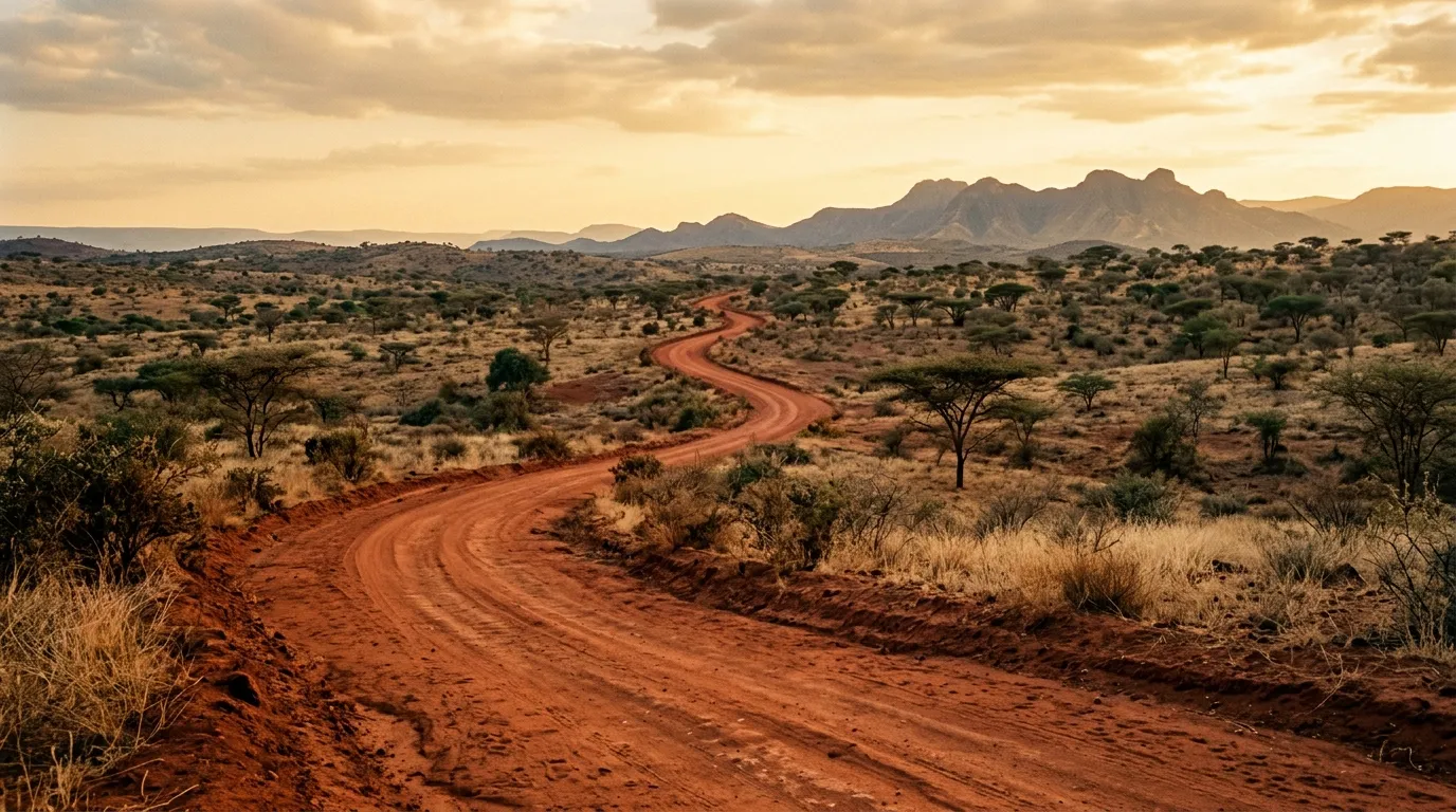
The 65 km from Key Afer to Turmi takes 2-3 hours on a gravel road that degrades progressively. The landscape descends into drier, hotter bush, and the first dry riverbeds appear — sandy channels crossing the road that are simple in dry season and impassable in wet season. The bush becomes thicker, the trees shorter and thornier, and the general impression is of entering a landscape that was not designed with vehicles in mind.
Turmi (4.9667° N, 36.5000° E) is a small town that serves as the base for exploring the southern Omo Valley. It has fuel (intermittent — we were lucky), basic accommodation, and a Saturday market similar to Key Afer’s but smaller. The town has a dusty, frontier character that feels appropriate to its location.
Day 2-3: The river crossings
South of Turmi
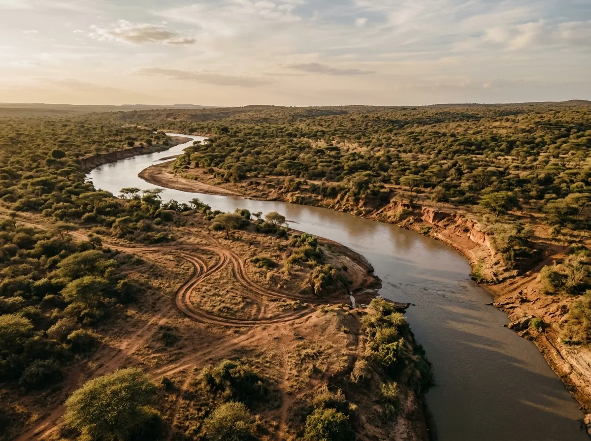
The tracks south of Turmi head toward the Omo River and the territory of the Karo and Dassanech people who live along its banks. These tracks are the most demanding driving on the route — narrow, overgrown with bush that scrapes both sides of the vehicle, and interrupted by seasonal watercourses that require assessment.
The Omo River itself is the major obstacle. During our visit (November, early dry season), the river was flowing but passable at specific crossing points known to the local communities. These crossing points shift from year to year as the river changes course during the floods. Current information from local people is the only reliable guide to which crossings are viable.
River crossing protocol (Omo Valley)
| Step | Action | Notes |
|---|---|---|
| 1 | Ask locals | The nearest village knows which crossings are current |
| 2 | Walk the crossing | Check depth, bottom surface, current strength |
| 3 | Assess depth | Maximum safe wading depth: 50 cm for most 4x4s |
| 4 | Check current | If the current pushes you off balance while wading, it will push the vehicle |
| 5 | Deflate tires | 18-20 PSI for sand approaches, normal for rocky bottom |
| 6 | Cross in low-range, first gear | Steady pace, no stopping, no sharp turns |
| 7 | Check for crocodiles | The Omo has Nile crocodiles. Do not wade without checking downstream pools. |
Step 7 is not a joke. The Omo River supports a population of Nile crocodiles, and the crossing points are also feeding areas. Dawit checked the downstream pools with binoculars before allowing us to wade the crossing on foot. He saw nothing. This was reassuring but not a guarantee — Nile crocodiles are masters of concealment. We crossed the river quickly and did not linger in the water.
The Karo villages
The Karo people live in small settlements along the Omo River, practicing flood-retreat agriculture — planting crops on the riverbanks as the water recedes. The Karo are known for their body painting — elaborate designs in white, red, and yellow pigments applied for ceremonies and (increasingly) for tourist photographs. The villages we visited were accessible only by tracks that ran along the riverbank through dense bush — single-vehicle width, branches scraping the roof, the occasional tree across the path that required chainsaw work (Dawit carried one).
The cultural interaction was mediated by Dawit, who speaks some Karo. The villages operate on a payment basis for visits — a community fee (typically 200-300 Birr per visitor) plus individual photo fees. This system has been criticized by some travel writers as commercialized, and there is a legitimate conversation about the ethics of cultural tourism in the Omo Valley. Our approach was simple: we paid the fees, we asked before photographing, we spent time in the villages rather than treating them as drive-through exhibits, and we accepted that our presence was a transaction. Whether this is the right approach is a question we do not claim to have resolved.
Day 4: Mago National Park approach
The track to Mago
Mago National Park (approximately 80 km east of Turmi) is a rarely visited reserve that borders the Omo River. The approach track is the most technically demanding on our route — overgrown bush, dry river crossings with soft sand, and sections where the “track” is a gap between thorn bushes that requires constant steering input to avoid scraping both sides simultaneously.
The drive took 4 hours for 80 km. Average speed: 20 km/h. We used low-range for approximately half the distance. The sand crossings required deflated tires (18 PSI) and the momentum technique — maintaining speed through soft sections without stopping. We got stuck once, in a sand channel that looked firm and was not. Recovery boards, twenty minutes of work, and a recalibration of our definition of “firm.”
The Mursi territory
The Mago approach passes through territory of the Mursi people, known internationally for the lip plates worn by Mursi women. The lip plates are cultural markers of beauty and maturity, inserted gradually over months. Visitors encounter Mursi women at the park entrance and along the approach road, where the photo-fee economy is well established (10-20 Birr per photograph).
The Mursi interaction is more intense than with other groups — the women approach vehicles directly, display their lip plates, and negotiate fees with a directness that some visitors find confronting. Dawit managed the interaction with a mix of language skill and cultural fluency that we could not have replicated. Without a guide in Mursi territory, the experience would be significantly more difficult.
Mago itself
We did not drive deep into Mago National Park — the tracks beyond the boundary are in poor condition, the wildlife is sparse compared to East African parks, and the heat in the lowlands (below 500 metres) was punishing. What Mago offers is isolation: we saw no other vehicles in the park, and the bush driving — dense, narrow, unpredictable — was among the most demanding we did in the Omo Valley.
Day 5: Dimeka market and return
The Hamer heartland
Dimeka (4.9833° N, 36.5167° E), approximately 40 km north of Turmi on a gravel road, hosts a Saturday market that is the primary commercial gathering for the Hamer people. The Hamer are the largest ethnic group in South Omo and among the most recognizable — the women wear elaborate necklaces and bracelets, style their hair with ochre and animal fat, and carry decorated goatskin clothing.
The Dimeka market is smaller and less touristed than Key Afer’s Thursday market. The driving to Dimeka is straightforward — gravel road, corrugated but passable, no river crossings. The market itself was a more relaxed cultural experience than the Karo villages — the Hamer are accustomed to visitors and the interaction felt more natural, less transactional.
Return to Jinka
The return to Jinka from Turmi (via Key Afer) retraces the outbound route. The climb back to 1,500 metres brought cooler temperatures and paved road, and the arrival in Jinka felt like returning to civilization — which, relative to the southern Omo tracks, it was.
Practical logistics
Fuel
Fuel in the Omo Valley is unreliable. The towns of Jinka, Turmi, and Key Afer have fuel stations, but “have” means the stations exist as structures. Whether they contain fuel on the day you arrive is a separate question governed by supply chain dynamics that are opaque and unpredictable.
| Location | Fuel availability | Notes |
|---|---|---|
| Jinka | Usually available | Two stations. Fill everything here. |
| Key Afer | Sometimes available | One station. Check on the way through. |
| Turmi | Intermittent | One station. Do not rely on it as primary supply. |
| Anywhere south of Turmi | Not available | Carry all fuel. |
Our fuel consumption over 300 km of valley tracks was approximately 65 litres — 22L/100km average, with spikes to 30L/100km on the sand crossings and bush tracks. With a 90-litre tank and 40 litres in jerry cans, we had margin. A vehicle with a 60-litre tank would need 60-70 litres in jerry cans to complete the circuit safely.
Water
Carry 40 litres for two people for five days. The valley floor temperatures reach 35-40 degrees Celsius, and the water sources (Omo River, village wells) are not safe for drinking without treatment. We used a combination of stored water (purchased in Jinka) and filtered river water (using a Sawyer filter).
Money
Cash only. ATMs do not exist south of Jinka (and the Jinka ATM is unreliable). Carry Ethiopian Birr in small denominations: 5, 10, 50, and 100 Birr notes. You will need them for photo fees, village entry fees, market purchases, fuel, food, guide payment, and the various small transactions that occur constantly during Omo Valley travel. We carried approximately 15,000 Birr ($450) and used most of it.
Health
The Omo Valley is a malaria zone. Prophylaxis is essential. We used Malarone (atovaquone/proguanil), which is effective and relatively low in side effects. The alternative is doxycycline, which is cheaper but causes sun sensitivity — a significant issue in a region where sun exposure is constant.
Tsetse flies are present in the bush areas. They bite through clothing and the bites are painful. Long sleeves and trousers reduce exposure. Insect repellent with DEET is partially effective.
Season and timing
| Month | Conditions | Accessibility | Recommendation |
|---|---|---|---|
| October – November | Early dry, rivers receding | Good, some crossings still high | Good. Best compromise of access and green landscape. |
| December – February | Dry season, hot | Excellent. All tracks passable. | Best for driving. Hottest period on valley floor. |
| March | Late dry, very hot | Good but dusty | Possible. Increasing discomfort. |
| April – September | Wet season | Poor to impassable | Do not attempt. River crossings dangerous, tracks flooded. |
Combining with other Ethiopia routes
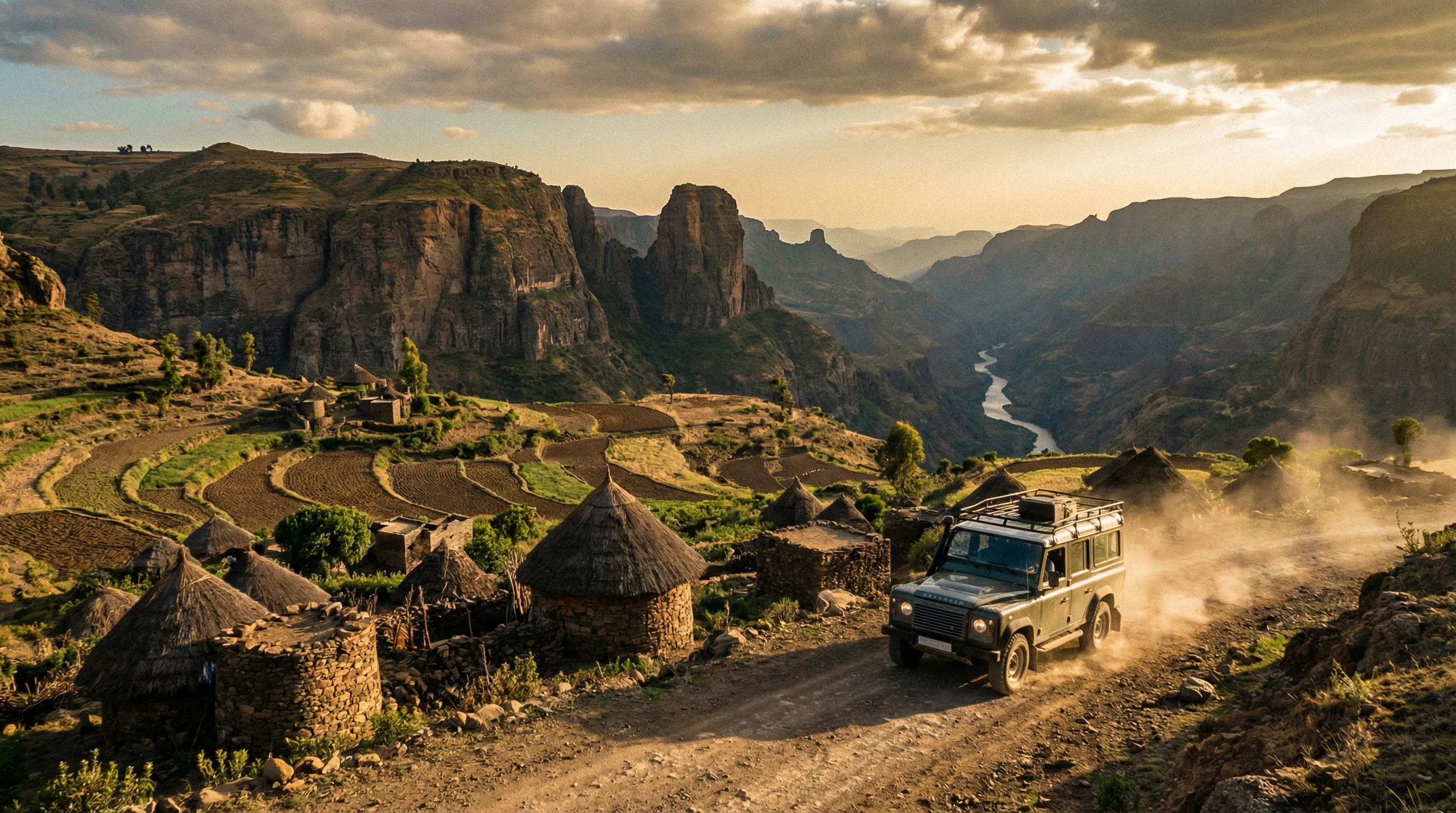
The Omo Valley is geographically separate from the northern routes. From Jinka, the Simien Mountains Circuit requires a return to Addis Ababa (700 km north) and then a further 700 km north to Debark — a logistical commitment of 2-3 travel days. The Danakil Approach Road is even more distant.
For a comprehensive Ethiopia itinerary: fly into Addis Ababa, drive south to the Omo Valley (3-5 days), return to Addis, fly to Gondar, drive the Simien circuit (4 days), drive to Mekelle, do the Danakil (3 days), fly back from Mekelle. Total: 2-3 weeks.
For Tanzania connections: the Omo Valley is approximately 300 km north of the Kenya border, which is approximately 400 km north of the Serengeti. The overland connection exists but is logistically complex — border crossings, vehicle permits, and road conditions between southern Ethiopia and northern Tanzania are variable. Most travelers fly between the two countries.
The honest summary
The Omo Valley is not about the driving. The tracks are challenging but they are a means, not an end — the end is access to a region of Africa that has changed less in the past century than perhaps anywhere else on the continent. The river crossings, the bush tracks, the sand channels — they are the price of reaching places where the Karo paint their bodies, where the Hamer jump bulls, where the Mursi women wear lip plates, and where the Thursday market at Key Afer brings five ethnic groups together in a commercial gathering that has been happening weekly for longer than anyone can remember.
Whether this access is entirely benign is a question we carry with us. The Omo Valley is under pressure — from dam construction upstream on the Omo River, from expanding sugar plantations, from the government’s “villagization” programs, and from tourism itself. The communities we visited are adapting to these pressures with the resilience that comes from living in a challenging environment for centuries. Our presence was a transaction within that adaptation. We do not romanticize it. We do recommend it, carefully, for travelers who come with respect, patience, and enough small-denomination Birr notes.
Bring a guide. Bring fuel. Walk every crossing.