Montenegro
Route Specimens
3 routes surveyed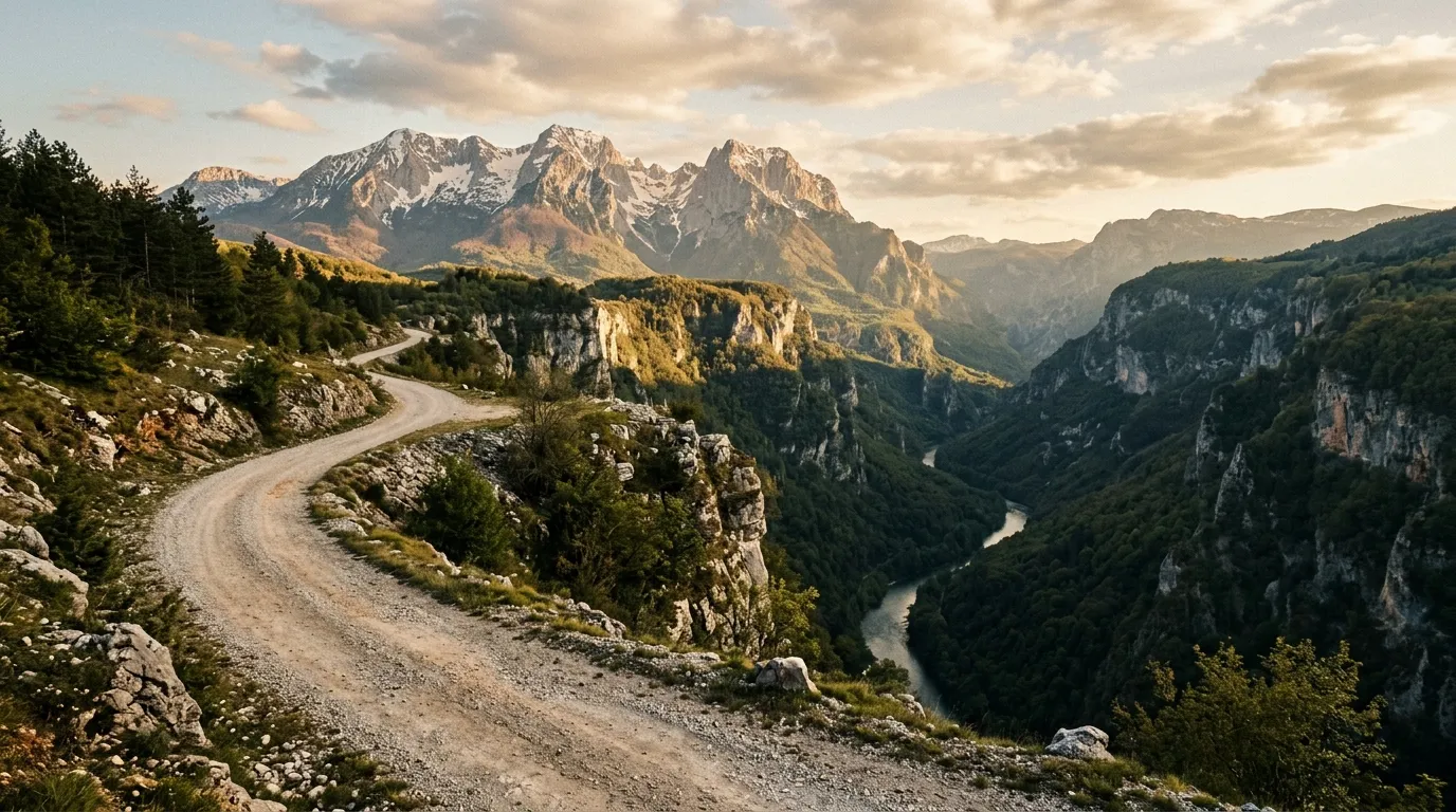
Montenegro Off-Road Routes
Montenegro is a country that could fit inside Connecticut but contains the altitude profile of Colorado. From the Adriatic coast to the Durmitor massif is about 150 km as the crow flies and roughly 2,500 metres of vertical gain, and the roads that connect the two inhabit every shade of surface condition from fresh EU-funded asphalt to tracks that are essentially suggestions left in the grass by the last vehicle to pass.
We drove three routes across the Montenegrin highlands during two separate trips — the Durmitor Ring Road, the Prokletije Border Trail along the Albanian frontier, and the Sinjajevina Highland Tracks across Europe’s largest mountain grassland. Between them, they cover the full range of Montenegrin off-road terrain: canyon-edge gravel, alpine forest tracks, and open grassland where the concept of a road dissolves into parallel tire marks on tundra-like plateau.
Montenegro’s advantage over its neighbours is concentration. Albania has wider wilderness but worse approach roads. Bosnia has equally dramatic scenery but the off-road routes are more scattered. In Montenegro, you can drive all three of our routes in a week and sleep in a proper bed every night, which matters more than it should after a day of switchbacks above the Tara Canyon.
Terrain classification
Montenegro’s off-road terrain falls into four categories, each with distinct character and vehicle requirements.
| Terrain type | Where you find it | Vehicle requirement |
|---|---|---|
| Canyon gravel | Tara Canyon rims, Moraca gorge | High-clearance 2WD |
| Alpine forest track | Durmitor flanks, Biogradska Gora | 4x4 recommended |
| Highland plateau | Sinjajevina, Bjelasica, Lukavica | 4x4 required |
| Rocky mountain track | Prokletije, Albanian border ridges | 4x4 with low-range |
The Dinaric Alps run the length of the country from northwest to southeast, and the off-road tracks mostly exist because shepherds needed to move livestock between seasonal pastures and nobody ever got around to paving the paths. This origin story is relevant: the tracks follow gradients that make sense for cattle, not vehicles, and they tolerate surface conditions that a cow can handle but a sedan cannot.
Our documented routes
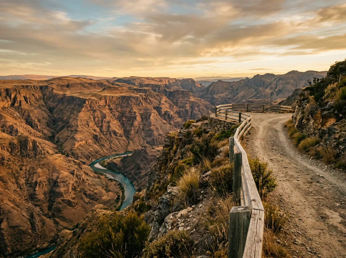
Durmitor Ring Road
| **Catalog: TB-ME-001 | Difficulty: Moderate | Distance: 120 km | Duration: 1 day** |
A full-day loop around Durmitor National Park, starting and ending in Zabljak. The route follows the eastern and southern flanks of the massif on a combination of gravel roads and forest tracks, with canyon viewpoints over the Tara and Susica rivers, mountain lakes accessible by short detours, and one extended section of track through dense beech forest that feels like driving through a tunnel. The surface is mostly graded gravel with sections of ungraded track — achievable in a 4x4 without low-range in dry conditions, though the forest section wants clearance and confidence after rain. Read the full route guide.
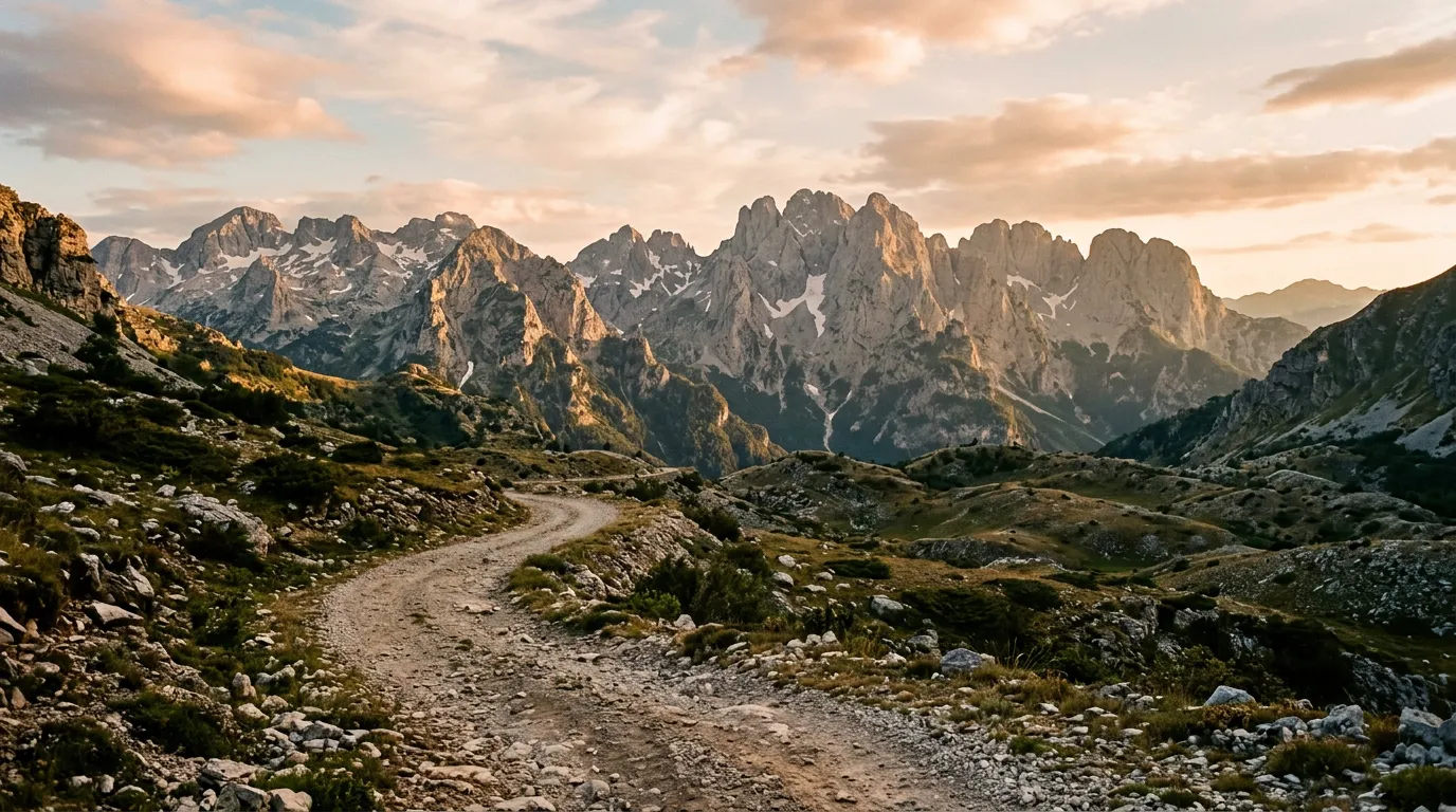
Prokletije Border Trail
| **Catalog: TB-ME-002 | Difficulty: Challenging | Distance: 85 km | Duration: 1 day** |
The wildest drive in Montenegro. The route follows gravel roads and mountain tracks along the Albanian border through the Prokletije range — the same Accursed Mountains that dominate northern Albania, seen from the Montenegrin side. Rocky tracks, river crossings, and one pass that took us three attempts to summit in loose rock. The landscape is alpine and harsh: bare limestone, glacier-carved valleys, snow patches surviving into July. You need a 4x4 and you need to be comfortable with exposure. Read the full route guide.
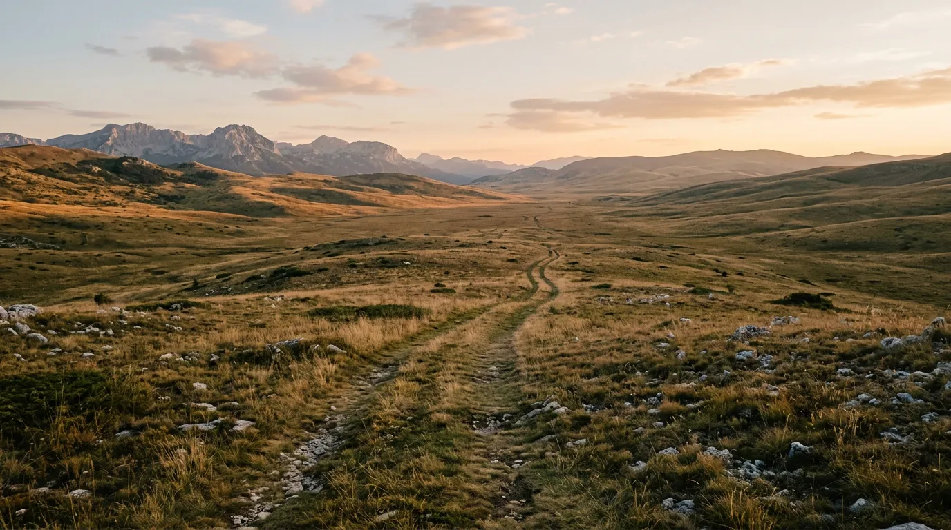
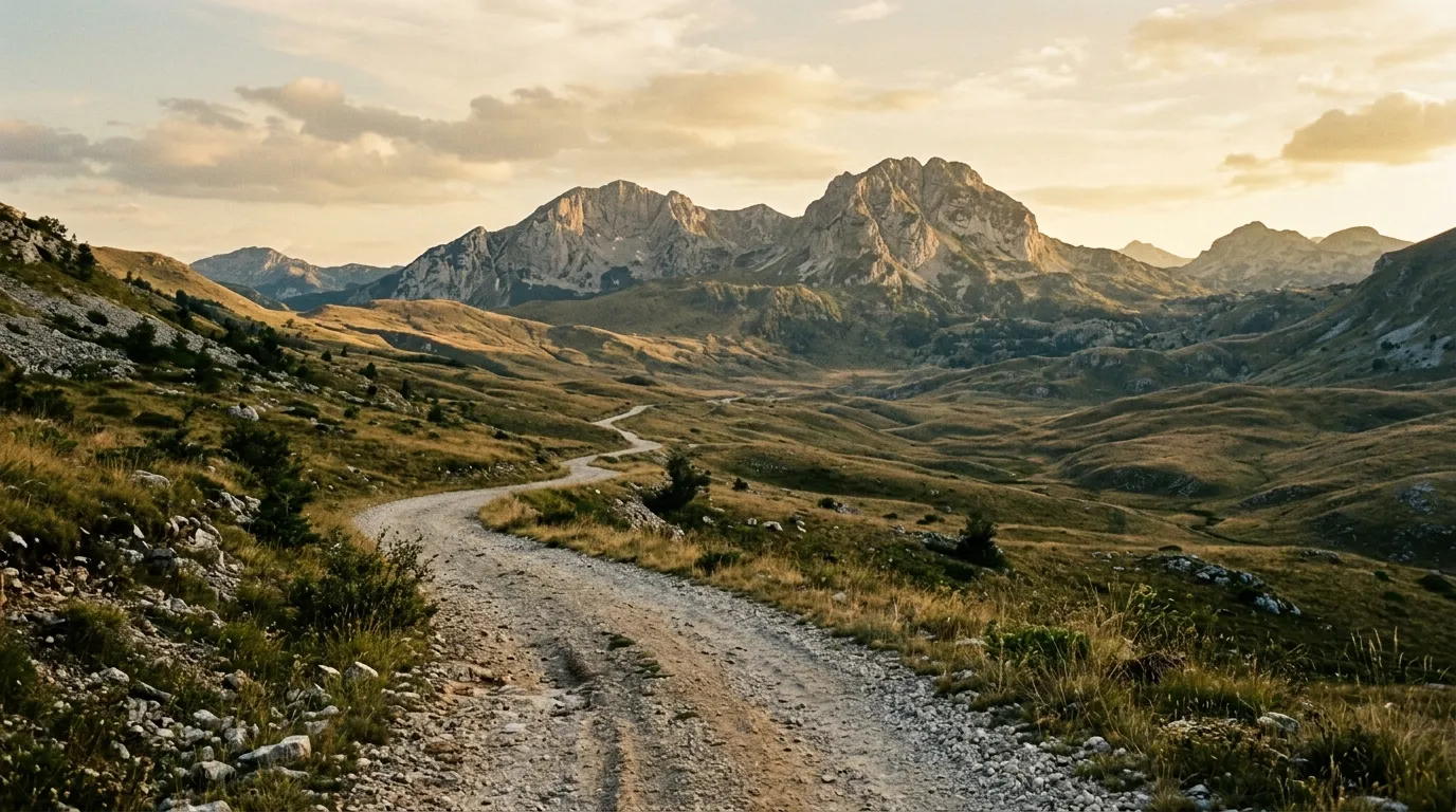
Sinjajevina Highland Tracks
| **Catalog: TB-ME-003 | Difficulty: Challenging | Distance: 60 km | Duration: Half day to full day** |
Europe’s highest grassland plateau, crisscrossed by unmarked tracks that connect shepherd camps, military-era observation points, and nothing in particular. Sinjajevina is the closest thing to steppe driving you will find in Europe — open, treeless, wind-raked grass at 2,000 metres with tracks that appear and disappear with the seasons. Navigation is the challenge here, not terrain difficulty. Wild horses. Shepherd dogs. No fences of any kind. Read the full route guide.
Practical information
Vehicle selection
A 4x4 is the minimum viable vehicle for our Montenegro routes. The Durmitor Ring Road is borderline manageable in a high-clearance 2WD during dry conditions, but the other two routes require 4WD as a baseline. Suzuki Jimny availability is good in Podgorica and along the coast. The Dacia Duster 4x4 is adequate for Durmitor but undersized for Prokletije. For the Prokletije trail specifically, we recommend a proper SUV — Pajero, Prado, or equivalent.
Rental agencies in Podgorica and Budva offer the best selection. Coast-based agencies tend to focus on city cars and convertibles for tourists. If you explain that you intend to drive “mountain roads,” most agencies will understand what you mean. A few will visibly worry.
Fuel planning
Montenegro’s fuel network is concentrated along the coast and on the Podgorica-Niksic-Zabljak corridor. Once you leave these axes, gaps appear.
| Route | Last reliable fuel | Next fuel | Gap |
|---|---|---|---|
| Durmitor Ring | Zabljak | Zabljak (loop) | ~120 km |
| Prokletije | Gusinje or Plav | Gusinje or Plav (loop) | ~85 km |
| Sinjajevina | Kolasin or Zabljak | Kolasin or Zabljak | ~80 km |
Carry a minimum 10L jerry can for any route. The Durmitor Ring and Sinjajevina are loops from fuel-accessible towns, so range is manageable. The Prokletije trail’s fuel gap is shorter in distance but the terrain burns fuel at a higher rate — our Jimny consumed 12L/100km on the rocky sections, versus its usual 8L on pavement.
Season and weather
The highland driving season runs May to October, with the core season being June to September. Snow closes the Sinjajevina tracks and the higher sections of the Prokletije trail by late October. Early-season driving (May-June) means snowmelt, mud, and swollen rivers — possible but wetter.
Afternoon thunderstorms are common in the highlands from June through August. They arrive fast, drop heavy rain for 30-60 minutes, and create instant mud on unpaved surfaces. If you see cumulonimbus building over the mountains by midday, plan to be off exposed tracks by 14:00 or be prepared for a muddy drive back.
Permits and access
Durmitor National Park charges an entry fee of 3 EUR per person (2024 prices), collected at gates on the main access roads. The Prokletije and Sinjajevina routes do not pass through gated areas. There are no vehicle permits or off-road driving restrictions beyond common sense and property rights — stay on established tracks and do not drive across cultivated land or active pastures.
Field notes
The Zabljak area is the logical base for Montenegro off-road driving. The town sits at 1,450 metres on the Durmitor plateau with fuel, accommodation, supermarkets, and restaurants. All three of our routes are accessible from Zabljak within 30-90 minutes of paved driving. Kolasin, on the Podgorica-Zabljak road, is a good secondary base — smaller but well-positioned for the Sinjajevina tracks.
Montenegrin mountain roads carry a particular hazard: logging trucks. The forestry industry uses the same gravel roads we drive, and a fully loaded logging truck descending a narrow mountain track at speed is a thing you encounter at corners you assumed were clear. The trucks have right of way because they cannot stop. Stay alert on gravel roads in forested areas, listen for engine noise beyond the next bend, and yield early and generously.
Mobile coverage in the highlands is erratic. Zabljak itself has good coverage. The Durmitor Ring has intermittent coverage. Sinjajevina has almost none. The Prokletije trail has none whatsoever for approximately 50 km of its length. Offline maps and a charged power bank are not optional.
The Montenegrin approach to mountain driving is fatalistic. Locals drive the highland tracks in vehicles that should not be driven on flat pavement — we were overtaken on the Sinjajevina plateau by a Fiat Punto that had no business being at 2,000 metres. Do not use local vehicle choices as a calibration for what is appropriate.
Related regions
Montenegro shares borders and geological formations with all three of its off-road neighbours. Albania continues the Accursed Mountains southward with the Valbona-to-Theth crossing. Bosnia and Herzegovina extends the Dinaric Alps westward with the Via Dinarica access tracks and Lukomir highland road. Romania offers the Carpathian mountain passes — different geology, similar driving character, and considerably more altitude.
Ground clearance, tire type, and 4x4 lock differ between agencies. Compare before you book.