Albania
Route Specimens
3 routes surveyed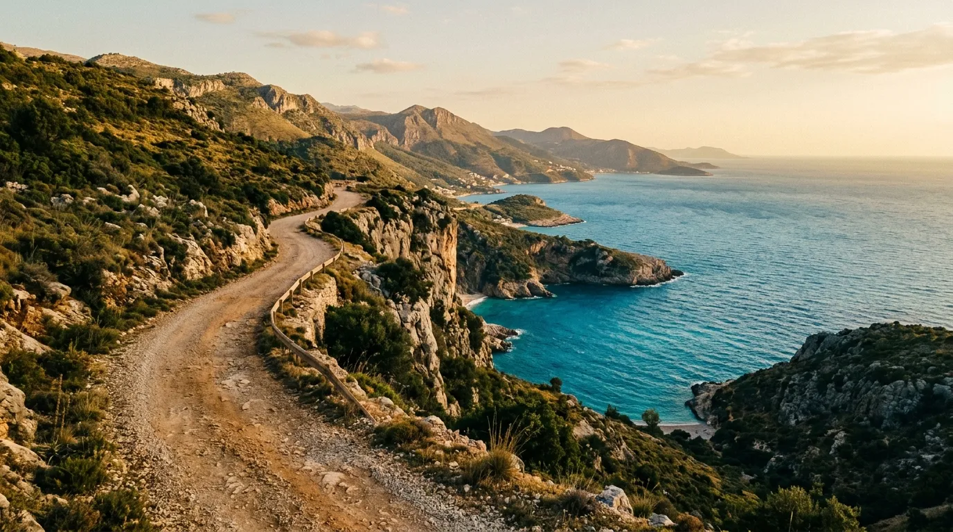
Albania Off-Road Routes
Albania is the country that other Balkan countries warn you about at the border. Not because of safety — that reputation died a decade ago — but because the roads will recalibrate your understanding of what constitutes a road. We have driven in 13 countries for this project, and Albania remains the only one where we found a national highway that was, by any conventional measurement, a goat track with ideas above its station. This was in 2023, on a road marked as SH8 on the map, somewhere between Permet and Korce. The asphalt had given up years earlier. What remained was a compacted surface of gravel, river cobble, and what we assumed was optimism.
This is not a complaint. This is what makes Albania the most interesting driving country in Europe.
The road network divides into three categories: the main highways connecting Tirana to the coast and south, which are mostly paved and occasionally excellent; the secondary roads connecting smaller towns, which oscillate between serviceable asphalt and unpaved gravel without warning; and the mountain tracks, which are their own genre entirely. We focus on that third category, plus the coastal tracks south of Vlora that serve as low-difficulty warm-ups for anyone not yet ready to point a vehicle at the Albanian Alps.
Terrain classification
Albania packs extraordinary geological variety into a country smaller than Maryland. The coast is limestone and Mediterranean scrub. The interior is schist, granite, and dense forest. The north is Alpine limestone — the same geological formation as the Austrian Alps, which is how it earned the name “Accursed Mountains” from medieval travellers who presumably lacked modern tires and suspension.
| Terrain type | Where you find it | Vehicle requirement |
|---|---|---|
| Coastal gravel | Albanian Riviera, Karaburun | High-clearance 2WD |
| Mountain switchbacks | Northern Alps, Valbona, Theth | 4x4 with low-range recommended |
| River valley tracks | Vjosa valley, Benca valley | High-clearance 2WD |
| Forest roads | Llogara, Lure, Shebenik | High-clearance 2WD sufficient |
| Alpine passes | Valbona Pass, Qafa e Thorres | 4x4 required |
Elevation changes are the story here. You can leave the Ionian coast at sea level and be at 1,800 metres within 40 km of horizontal distance. The roads that accomplish this feat were not designed by engineers so much as negotiated between terrain and ambition, and they show it.
Our documented routes
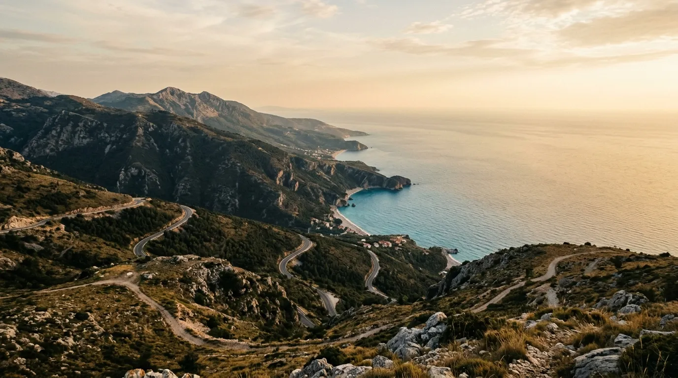
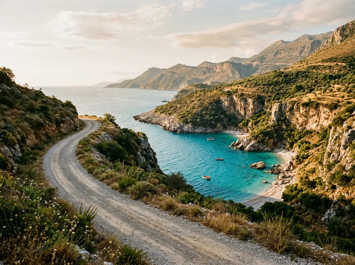
Albanian Riviera Coastal Tracks
| **Catalog: TB-AL-001 | Difficulty: Moderate | Distance: 95 km | Duration: 1-2 days** |
The gentlest introduction to Albanian off-road. Gravel roads that connect hidden beaches and clifftop villages along the southern coast, from Dhermi down to the Greek border. The surface ranges from well-graded gravel to rocky beach access tracks that test your clearance but not your courage. What makes this route special is the swimming — there are beaches accessible only by these tracks that remain genuinely empty in peak season. A Dacia Duster handles most of it. The beach access spurs to Gjipe and Llamani want something with a bit more clearance. Read the full route guide.
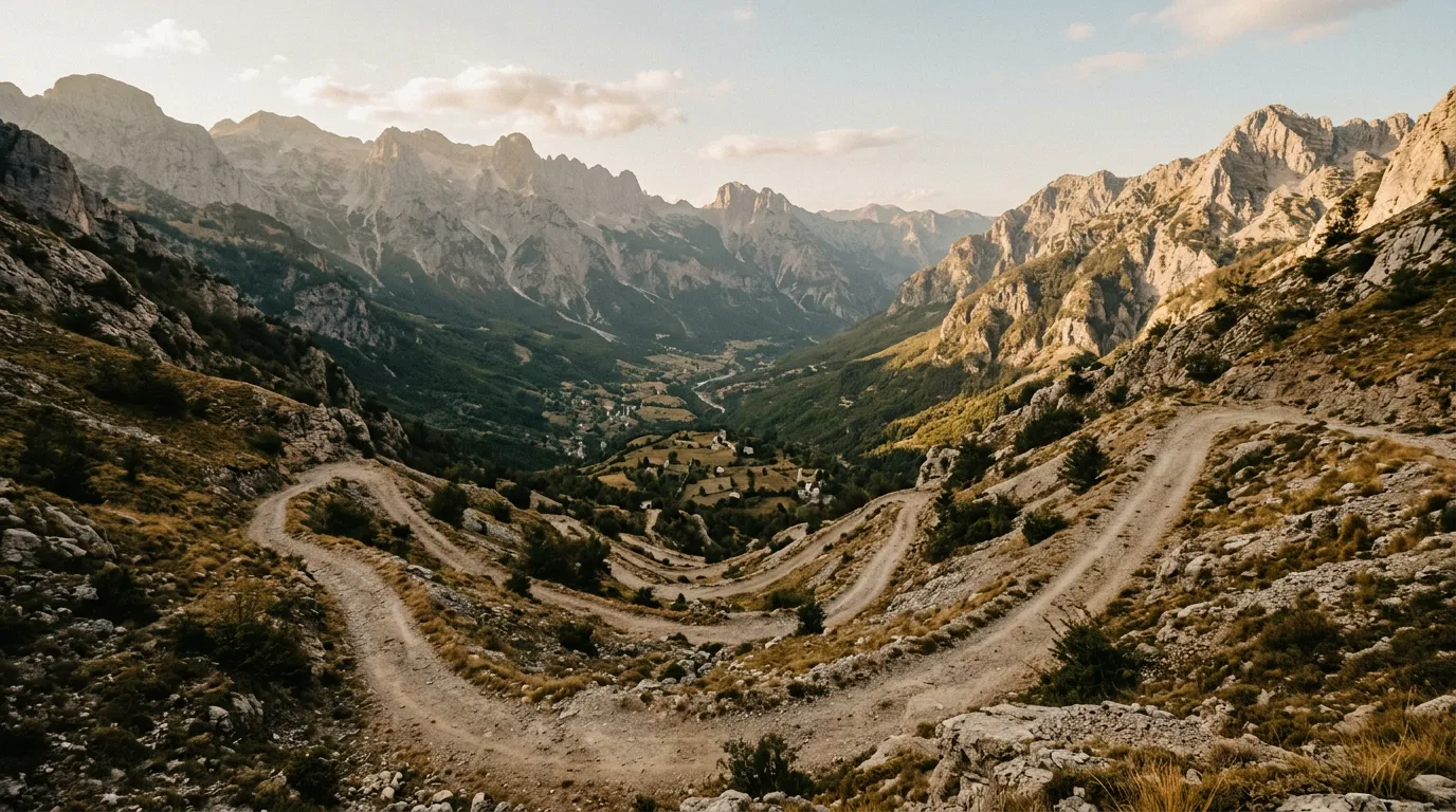
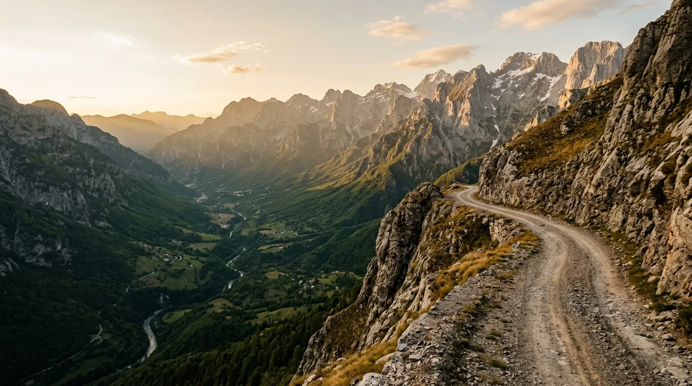
Valbona to Theth by 4x4
| **Catalog: TB-AL-002 | Difficulty: Challenging | Distance: 65 km | Duration: 1 day** |
The trail that most people hike — we drove it. The road between Valbona and Theth crosses the high pass of the Accursed Mountains through switchbacks that make the Tusheti Road in Georgia look civil. River crossings, rockfall zones, and gradients that justify low-range. The views are Alpine in the truest sense: snow-streaked peaks, glacial valleys, stone-walled villages that have not changed their footprint in centuries. This is the headline route for Albania, and it earns the difficulty rating on every kilometer. Read the full route guide.
Llogara Pass and Beyond
| **Catalog: TB-AL-003 | Difficulty: Easy | Distance: 45 km | Duration: Half day** |
Starting from Llogara Pass at 1,027 metres — the paved road from Vlora crests here with views that stop conversation — a network of forest tracks branches into the mountain interior. Shepherd trails, old military roads from the Hoxha era, and seasonal logging tracks lead through dense pine and fir forest to viewpoints over the Ionian Sea and the Karaburun Peninsula. None of it is technically difficult. All of it is worth the detour. A decent 2WD with clearance handles everything here. Read the full route guide.
Practical information
Vehicle selection
The Dacia Duster is the rental workhorse of Albania. Most agencies in Tirana and Saranda offer them, and they handle the coastal routes and Llogara tracks comfortably. For Valbona to Theth, you need a proper 4x4 — Suzuki Jimny or the occasional Mitsubishi Pajero from specialist agencies. The Jimny is widely available and handles Albanian mountain tracks well, despite its limited cargo space. Book any 4x4 at least two weeks in advance during summer.
Fuel planning
Albanian fuel stations are frequent along the coast and on the main north-south corridor. The problem areas are the mountain interiors. Our longest fuel gap is approximately 130 km (Valbona to Theth round trip from Bajze), though conservative driving on mountain roads burns fuel faster than the distance suggests.
| Route | Last reliable fuel | Next fuel | Gap |
|---|---|---|---|
| Riviera Coastal | Himara or Saranda | Multiple coastal stations | ~40 km max |
| Valbona to Theth | Bajze or Shkoder | Shkoder (return) | ~130 km |
| Llogara | Vlora or Orikum | Vlora or Himara | ~50 km |
Season and weather
The driving season spans April to November, with significant variation by route. Coastal tracks are accessible year-round in dry weather. Mountain routes above 1,500 metres are typically snow-free from June to October. The Valbona Pass can be impassable until late June in heavy snow years — check locally before committing. Summer heat on the coast is intense (35-40 degrees Celsius in July and August) but mountain tracks stay comfortable at altitude.
Permits and access
Albania requires no permits for off-road driving. There are no national park entry fees for the routes we cover, though this may change as the country develops its tourism infrastructure. The Valbona Valley National Park has no enforced gate system at time of writing — you drive in, you drive out.
Field notes
Albanian drivers are simultaneously the most aggressive and the most helpful people on the road. They will overtake you on a blind corner at speed, and then stop to push you out of a ditch an hour later. We received directions, tire-changing assistance, and three glasses of raki from strangers on our first day of driving.
The road surface can change character within 500 metres. Maps — including Google Maps, OsmAnd, and Maps.me — are unreliable for surface classification. A road marked as asphalt may have reverted to gravel. A track marked as a path may have been recently graded. Trust the map for routing, trust your eyes for surface.
Mobile coverage is good along the coast and major valleys. In the mountains north of Shkoder, coverage drops to zero in the valleys and becomes intermittent on ridgelines. Download offline maps before you leave Tirana.
Water: not the survival concern it is in Jordan or Oman, but carry 2 litres per person for any mountain route. The Albanian Alps have springs, but finding them requires local knowledge.
Related regions
If Albania’s mountain driving appeals to you, Montenegro offers similar terrain across the border with more established infrastructure. Bosnia and Herzegovina has the Via Dinarica access tracks through equally wild but geologically different mountains. For a more extreme version of Albania’s combination of switchbacks and river crossings, Georgia delivers at a larger scale and higher altitude.
Ground clearance, tire type, and 4x4 lock differ between agencies. Compare before you book.