Tanzania
Route Specimens
3 routes surveyed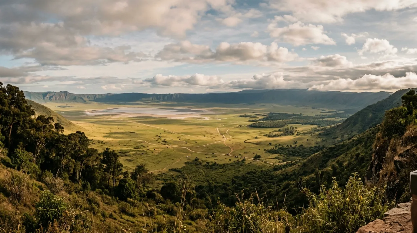
Tanzania Off-Road Routes
We had been warned about black cotton soil. Multiple guides mentioned it. A man at a fuel station in Arusha described it with the single word “sticky” and then shook his head in a way that suggested the word was doing about five percent of the necessary work. None of this prepared us for the moment our Land Cruiser stopped moving forward despite all four wheels turning. Black cotton soil, when wet, behaves less like soil and more like industrial adhesive — it grabs the tires, packs into the wheel arches, builds up on the chassis, and adds approximately 200 kg to your vehicle weight before you have traveled 50 metres. When dry, the same soil cracks into slabs that rattle your kidneys and test your shock absorbers’ will to live. This is the dominant surface of the Serengeti’s western corridor, and driving on it is one of the more memorable sensory experiences East Africa has to offer.
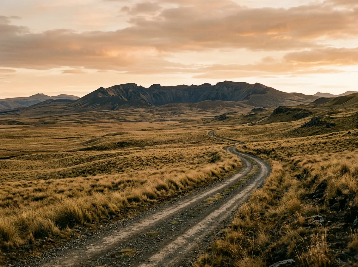
Tanzania is not the easiest country to self-drive. The national parks charge substantial entry fees, the bureaucracy around vehicle permits requires patience, and the infrastructure between major towns can be generously described as evolving. But the driving — the actual act of navigating a vehicle through landscapes that contain more large mammals per square kilometre than anywhere else on Earth — is without parallel. The Serengeti alone covers 14,750 square kilometres of savanna, woodland, and riverine forest connected by a network of tracks that range from well-graded gravel to suggestions scratched into the grass by previous vehicles.
We have driven three routes across Tanzania’s national park system: the Serengeti Western Corridor from Seronera to the Grumeti River, the Ngorongoro Rim Tracks along the edge of Africa’s largest intact caldera, and the Ruaha River Crossings in Tanzania’s biggest and least-visited national park. Between them, they cover an elevation range of nearly 2,000 metres, terrain types from volcanic crater rim to seasonal sand river, and wildlife encounters that would cost thousands of dollars on a guided safari — experienced instead from behind the wheel of your own rented 4x4.
Terrain classification
Tanzania’s off-road terrain is shaped by two geological events: the formation of the East African Rift Valley, which created the highlands, craters, and escarpments; and several million years of volcanic activity, which deposited the soils that make driving here so distinctive. The terrain changes not just with geography but with season — a track that is a smooth, packed surface in August becomes a waterlogged trench in April.
| Terrain type | Where you find it | Vehicle requirement |
|---|---|---|
| Black cotton soil | Serengeti western corridor, Serengeti south | 4x4 with high clearance (impassable when wet) |
| Savanna track | Serengeti central, most park roads | 4x4, moderate clearance |
| River crossing | Ruaha, western Serengeti, Selous fringes | 4x4 with low-range, wading assessment |
| Crater rim road | Ngorongoro | 4x4 (steep, muddy in forest sections) |
| Sand track | Ruaha riverbeds, Lake Manyara approaches | 4x4, deflated tires for soft sections |
| Graded gravel | Main park arterials, Ngorongoro to Serengeti | 4x4 (park requirement), comfortable driving |
The single most important terrain variable in Tanzania is moisture. Dry-season tracks are often excellent — hard-packed, predictable, fast enough that you need to remember the 40 km/h park speed limit. The same tracks in wet season can be completely impassable, not just difficult. We are not talking about puddles. We are talking about tracks that transform into waist-deep channels of liquid mud extending for kilometres.
Our documented routes
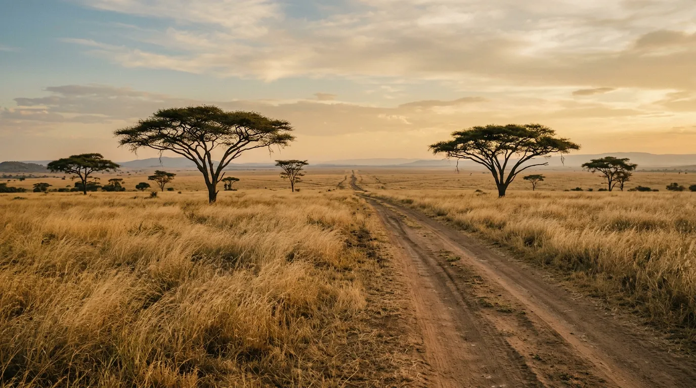
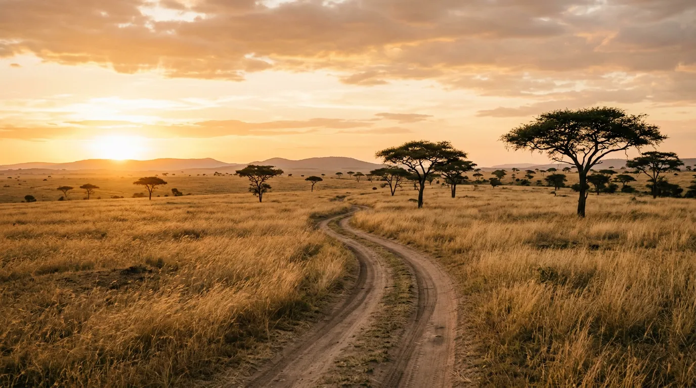
Serengeti Western Corridor
| **Catalog: TB-TZ-001 | Difficulty: Challenging | Distance: 130 km | Duration: 1-2 days** |
The migration route. From Seronera — the Serengeti’s central hub — west to the Grumeti River along tracks that cross the path of the Great Migration. Between June and July, approximately 1.5 million wildebeest move through this corridor toward the Mara River, and the tracks that parallel their route put you in the middle of one of the planet’s most extraordinary wildlife events. The driving is demanding: black cotton soil dominates the western sections, river crossings require depth assessment, and the remoteness means no recovery service if you break down. Carry two spare tires, a satellite phone, and enough water for 48 hours. The wildlife — including lion prides that use the tracks as hunting corridors — makes every hour behind the wheel worth the preparation. Read the full route guide.
Ngorongoro Rim Tracks
| **Catalog: TB-TZ-002 | Difficulty: Moderate | Distance: 65 km | Duration: 1 day** |
The crater. Ngorongoro is a caldera 19 km across and 600 metres deep, and the tracks that ring its rim pass through montane forest thick with moss and mist before delivering you to viewpoints where the entire crater floor is visible — lakes, grassland, hippo pools, and the dark shapes of elephants moving between feeding areas. The descent to the crater floor is controlled (one road down, one road up, both steep and occasionally muddy), and the floor itself is a network of short tracks connecting the major wildlife areas. It is possible to see the Big Five in a single day on the crater floor, which is a claim most parks make and Ngorongoro actually delivers. The driving is moderate but the altitude — the rim sits above 2,300 metres — means cooler temperatures and morning fog that reduces visibility on the forest sections. Read the full route guide.
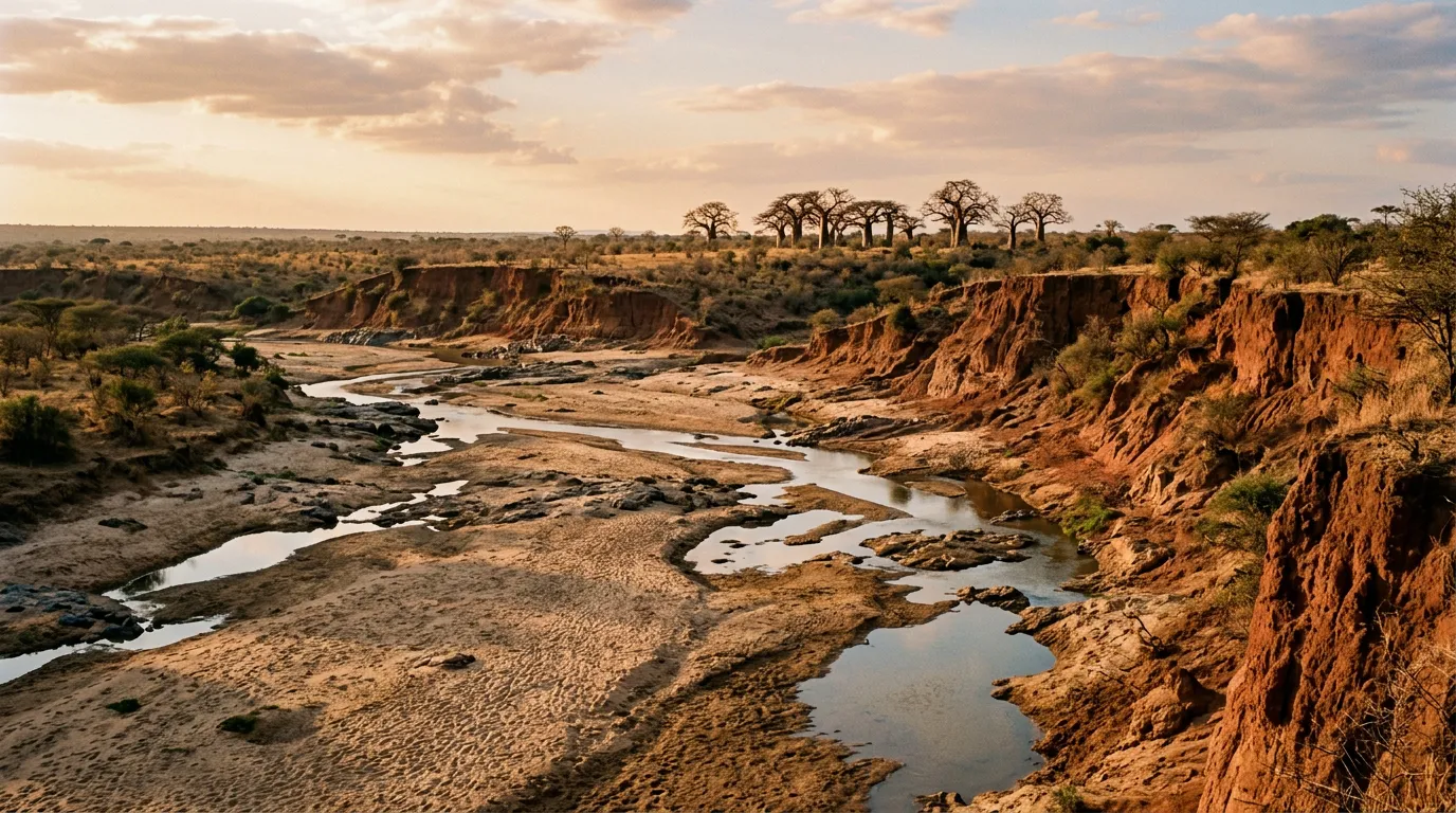
Ruaha River Crossings
| **Catalog: TB-TZ-003 | Difficulty: Challenging | Distance: 100 km | Duration: 2-3 days** |
The remote one. Ruaha National Park is Tanzania’s largest at 20,226 square kilometres, and on the days we drove it we saw a total of three other vehicles. The park’s tracks follow the Great Ruaha River and its tributaries — seasonal waterways that run full during the rains and reduce to sand channels studded with pools during the dry season. The river crossings are the defining feature: shallow enough to wade in dry season, deep enough to drown a vehicle in wet season, and requiring assessment every time because the bottom shifts with each flood cycle. The wildlife density rivals the Serengeti but the species mix is different — Ruaha is one of the few places where you see both Greater and Lesser kudu, and the lion population here is among the largest in East Africa. Read the full route guide.
Practical information
Vehicle selection
Self-drive safari in Tanzania means a 4x4. There is no alternative and no exception. Park regulations require four-wheel drive for entry, and the terrain enforces this requirement with mechanical indifference. The vehicle of choice is a Toyota Land Cruiser — the 70 Series if you can find one, the Prado if you cannot. Rental agencies in Arusha and Dar es Salaam offer safari-equipped vehicles with roof hatches (essential for game viewing), long-range fuel tanks, and camping equipment. Expect to pay $150-250 per day for a properly equipped Land Cruiser, which sounds expensive until you compare it to the $400-800 per person per day that guided safaris charge.
The Suzuki Jimny, which is our default vehicle for many countries, is technically allowed in the parks but is too small for serious safari driving. The limited fuel range, minimal storage space, and absence of a roof hatch make it impractical for multi-day park trips. This is Land Cruiser country.
Fuel planning
Tanzania’s fuel infrastructure is reliable in the towns and absent in the parks. The critical numbers:
| Route | Last reliable fuel | Next fuel | Gap |
|---|---|---|---|
| Serengeti Western Corridor | Seronera (park petrol station, unreliable) | Mwanza or return to Seronera | ~300 km round trip |
| Ngorongoro | Karatu (town before the crater) | Karatu (return) | ~150 km round trip |
| Ruaha | Iringa | Iringa (return) | ~400 km round trip |
Seronera has a petrol station, but “has” is doing generous work — it runs out regularly, especially in peak season. Carry a minimum of 40 litres of extra fuel for the Serengeti and plan your range assuming consumption of 20-25 litres per 100 km (the combination of low-speed driving, 4x4 engagement, and air conditioning in 35-degree heat destroys fuel economy).
Season and weather
The driving season aligns with the dry seasons: the long dry from June to October and the short dry in January to February. The long rains (March to May) make most park tracks impassable — this is not an exaggeration but a literal description of conditions where tracks disappear under water and black cotton soil becomes a slurry. The short rains (November to December) are less severe but still risky for the western Serengeti and lower areas of Ruaha.
The migration timing adds another layer to planning. The western corridor is most rewarding in June-July (wildebeest crossing the Grumeti). Ngorongoro is good year-round in dry season. Ruaha peaks in September-October when animals concentrate around the remaining water sources.
Permits and access
Tanzania’s national park fees are substantial and structured to maximize revenue. As of 2026:
| Park | Entry fee (per person/day) | Vehicle fee (per day) | Camping fee |
|---|---|---|---|
| Serengeti | $82 | $40 | $30-50 |
| Ngorongoro | $70 | $40 (crater descent extra) | $50 |
| Ruaha | $30 | $40 | $30 |
Fees are paid via electronic card (Tanapa card) loaded at park gates or in advance online. Cash is not accepted at most gates. Load your card in Arusha before departing — the gate card machines have a relationship with reliability that can charitably be described as intermittent.
Self-drive is legal in all three parks, but the western Serengeti corridor may require a park-assigned guide during certain periods. Check with TANAPA (Tanzania National Parks Authority) before your trip.
Field notes
Tanzania rewards patience and punishes rushing. Park speed limits are 40 km/h for a reason — the combination of wildlife on the road, unpredictable surfaces, and dust that obscures the vehicle ahead makes faster driving genuinely dangerous. We averaged 20-25 km/h across all three routes, and that speed gave us time to spot the leopard draped across a sausage tree branch that we would have driven past at 60.
The other drivers you meet on park tracks are almost exclusively guided safari vehicles — Land Cruisers and Land Rovers carrying tourists who have paid significant money to be driven. The self-driver is an oddity. Expect curious looks from guides and interested questions from tourists at rest stops. The guides are often the best source of current track information: they drive these roads daily and know which crossings are passable and which turns have been washed out.
Mobile coverage is limited to major towns and park headquarters. Seronera has intermittent coverage. Ngorongoro crater rim has coverage. Ruaha has effectively none. A satellite phone or satellite communicator (Garmin inReach, Spot) is not optional for Ruaha and strongly recommended for the western Serengeti.
Water: carry 5 litres per person per day minimum. More if you are camping without access to lodge water supplies. The heat at lower elevations — Ruaha, western Serengeti — is serious, often exceeding 35 degrees Celsius, and dehydration compounds every other problem.
Related regions
If Tanzania’s combination of safari driving and challenging terrain appeals to you, consider Ethiopia for even more extreme driving with the Simien Mountains and Danakil Depression. South Africa offers the most established 4x4 trail network in Africa — Baviaanskloof and Sani Pass are world-class routes with better infrastructure. Namibia provides the self-drive safari experience with less bureaucracy and more solitude, though the wildlife density cannot compete with the Serengeti.
Ground clearance, tire type, and 4x4 lock differ between agencies. Compare before you book.