F26 Sprengisandur
There is a moment on the Sprengisandur route, approximately 80 km from the southern start and 120 km from the northern end, where you stop the vehicle, turn off the engine, open the door, and hear nothing. Not quiet — nothing. No wind (if you are lucky with the weather, which in Iceland means approximately one day in seven). No water. No birds. No distant traffic. No mechanical hum. Nothing. The black sand desert stretches to the horizon in every direction. The sky sits low and grey. The two largest glaciers in Iceland — Hofsjokull and Vatnajokull — are visible as white bands on the edge of vision, but they are too far away to make sound and too abstract to feel real. You are standing in the middle of the island, in the middle of the Atlantic, in the middle of the most complete silence we have experienced anywhere on Earth.
Then the wind starts again and the silence ends and you get back in the vehicle because you are cold.
Sprengisandur is the highland route that the Kjolur route prepares you for. Where Kjolur has bridges and a geothermal tourist attraction and a clear marketing proposition as “the accessible interior,” Sprengisandur has river fords, a single mountain hut, and 200 km of terrain that exists on the boundary between landscape and abstraction. Icelandic sagas describe the Sprengisandur as a place inhabited by outlaws and trolls. Having driven it, we consider the outlaw theory reasonable and the troll theory unsupported by evidence but not falsifiable given the visibility conditions.
We drove Sprengisandur from south to north in late July, in a Toyota Land Cruiser Prado with a snorkel. The snorkel was not strictly necessary for the crossings we encountered, but it provided a margin of error that we valued. The drive took ten hours, including river assessment stops and a 90-minute break at the Nyidalur mountain hut. We would not describe it as fun. We would describe it as essential.
Route overview
The F26 runs approximately 200 km from Hrauneyjar (south, elevation ~500m) to the junction with Route 842 near Godafoss (north, elevation ~300m). The route crosses the highland interior through volcanic sand desert, passing between Hofsjokull glacier (west) and Vatnajokull glacier (east). The highest point is approximately 900 metres.
| Segment | Distance | Elevation | Terrain | Time |
|---|---|---|---|---|
| Hrauneyjar to F26 highland start | 20 km | 500m – 600m | Gravel, easy | 30 min |
| Highland start to first river fords | 40 km | 600m – 750m | Volcanic sand, gravel | 1.5 hrs |
| River ford zone (south) | 15 km | 750m | Multiple crossings, sand | 1 hr |
| Southern fords to Nyidalur | 25 km | 750m – 850m | Black sand desert | 1 hr |
| Nyidalur to high plateau | 30 km | 850m – 900m | Volcanic desert, exposed | 1.5 hrs |
| High plateau to river ford zone (north) | 40 km | 900m – 700m | Descending, sand and gravel | 1.5 hrs |
| Northern fords to Ring Road junction | 30 km | 700m – 300m | Gravel, improving surface | 1 hr |
Total driving time: approximately 8 hours. With river assessment stops and the Nyidalur break, budget 10 hours.
The southern approach: Hrauneyjar to the highland
Hrauneyjar (km 0)
Hrauneyjar is a highland centre on Route 26, south of the F-road section. It has fuel, basic accommodation, and a restaurant. This is your last chance for fuel, hot food, and human company for the next 200 km. Fill the tank. Use the bathroom. Check road.is one final time.
The F26 begins north of Hrauneyjar with a barrier gate. If it is open, you proceed. The road condition sign will indicate the status. Proceed means proceed. Impassable means do not proceed. Between these two options lies a range of conditions described in Icelandic with a precision that we found admirable and a directness that we found humbling.
First section: gravel and volcanic sand (km 20–60)
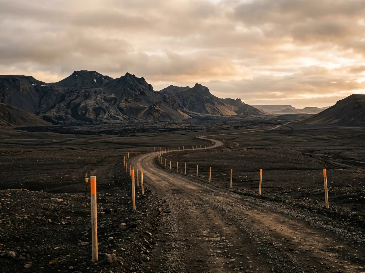
The initial 40 km after entering the highland is a gradual acclimatisation. The gravel is compacted. The terrain is open — mossy lava fields giving way to bare volcanic sand as you gain elevation. The road is clear and well-marked with stakes (road markers driven into the ground at intervals). You develop a rhythm: gravel, sand, gravel, sand. The vehicle settles. The terrain empties.
The first sign that you have left the familiar world is the absence of landmarks. On Kjolur, you have glaciers on both sides and geothermal activity at the midpoint. On Sprengisandur, you have sand. Black sand, grey sand, brown sand. The texture varies. The colour varies. The fundamental character does not: you are driving through a volcanic desert in the North Atlantic, and the desert has no interest in providing visual variety for your benefit.
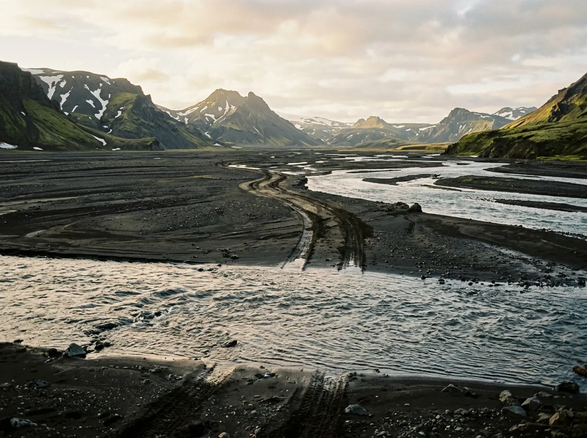
The southern river fords (km 60–75)
The first river crossings appear approximately 60 km into the highland section. These are braided glacial streams — the outflow from Hofsjokull — that cross the track in channels of varying depth and width. The number and size of the channels change with the season, the weather, and the time of day.
We encountered four crossable channels in this section. Assessment protocol:
- Stop the vehicle well back from the water’s edge.
- Get out. Put on waterproof boots (essential equipment, not optional).
- Walk the crossing. Check the bottom (gravel is good, sand is acceptable, silt is dangerous). Check the depth at the deepest point.
- If the water is below your knee: cross in the vehicle in low-range second gear at walking pace, creating a bow wave ahead of the bumper.
- If the water is above your knee: reconsider.
Our crossings in late July ranged from 20 to 40 cm deep. The bottom was gravel in all four channels. The water was approximately 4 degrees Celsius, which we know because the waterproof boots were not entirely waterproof. The crossings were manageable but required care — the current was perceptible, and the temptation to rush is the enemy of good fording technique.
| Crossing | Depth (late July) | Bottom | Width | Notes |
|---|---|---|---|---|
| Ford 1 | 20 cm | Gravel | 8 m | Straightforward |
| Ford 2 | 30 cm | Gravel/sand | 12 m | Wider, slower approach |
| Ford 3 | 40 cm | Gravel | 10 m | Deepest southern crossing |
| Ford 4 | 25 cm | Gravel | 6 m | Narrow, moderate current |
These depths are specific to late July at morning crossing time. In early July, after peak snowmelt, they can be 50-70 cm. In warm afternoons, they rise throughout the day. Cross in the morning.
The core: Sprengisandur desert
Nyidalur (km 100)
Nyidalur is a mountain hut and campsite sitting at 850 metres in the middle of the Sprengisandur desert. It is the only structure between Hrauneyjar and the northern lowland — the only evidence of human construction in 200 km. The hut is operated by Ferdalag Islands (fi.is), open July to August, and offers bunk beds, a basic kitchen, and a warden who may or may not be in residence. Book a bed if you plan to stay. If you are day-tripping, the hut is a natural rest stop — shelter from wind, a place to eat, and the last reliable water refill point.
We stopped for 90 minutes. We ate lunch in the hut’s common room with a German couple who were driving the opposite direction and an Icelandic couple who had been camping for three days and looked simultaneously weathered and content. The conversation covered river depths (the German couple reported the northern fords were shallow that morning), weather forecasts (pointless but comforting), and vehicle performance on volcanic sand (the Icelanders were in a modified Land Cruiser 70 and were politely unimpressed by our Prado).
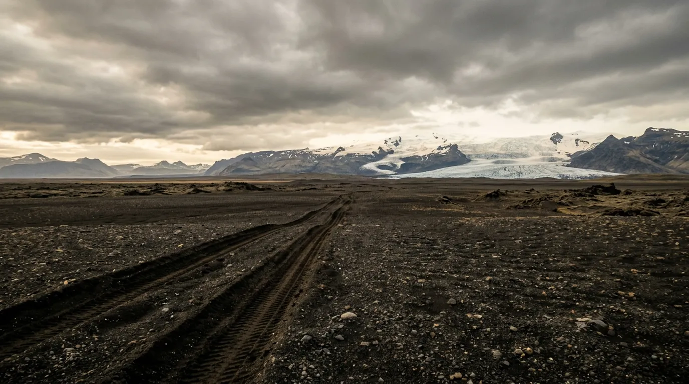
The high plateau (km 100–150)
North of Nyidalur, the route reaches its most austere section. The elevation climbs to approximately 900 metres. The terrain is black volcanic sand with occasional patches of grey pumice and brown tephra. Vegetation is absent. The road is two tire tracks in the sand, marked by stakes. The stakes are your navigation system — follow them, and only them.
This is where the silence lives. The wind drops occasionally, and in those moments the desert is the quietest place we have driven. The sand absorbs sound. The sky absorbs light. The glaciers, now visible on both horizons, absorb scale — they are so large and so white and so far away that they serve as a reference for distance rather than a point of interest, and the distance they reference is vast.
The driving here is not technically difficult. The surface is firm enough for a 4x4 at moderate speed (30-40 km/h). The challenge is psychological: maintaining concentration on a road that offers no variation, no turns, no climbs, no descents, no features of any kind for 50 km. We rotated drivers at Nyidalur. The fresh eyes helped.
The northern descent: river fords and lowland
Northern river fords (km 150–175)
The northern river crossings are fed by Vatnajokull — a larger glacier than Hofsjokull, producing more meltwater. In our experience, the northern fords were shallower than the southern ones in late July, but this varies significantly with conditions and season. The same assessment protocol applies: stop, walk, check, decide.
We crossed five channels in the northern section. Three were under 25 cm and unremarkable. One was 35 cm with a soft sand bottom that required careful line selection to avoid sinking. The fifth was 45 cm at its deepest point, with a rocky bottom and moderate current — the most serious crossing of the day. We walked it twice, chose a line slightly upstream of the obvious track (where the bottom was gravel rather than sand), and crossed in low-range first gear at crawling speed. The bow wave reached the headlights. The engine stayed dry. The relief was tangible.
Descent to the Ring Road (km 175–200)
Below the northern fords, the terrain softens. Moss appears. Grass follows. The volcanic sand gives way to gravel, then to rough gravel, then to good gravel. The road condition sign at the northern barrier gate showed “passable” when we exited, which given the drive we had just completed, felt like an understatement of admirable Icelandic restraint.
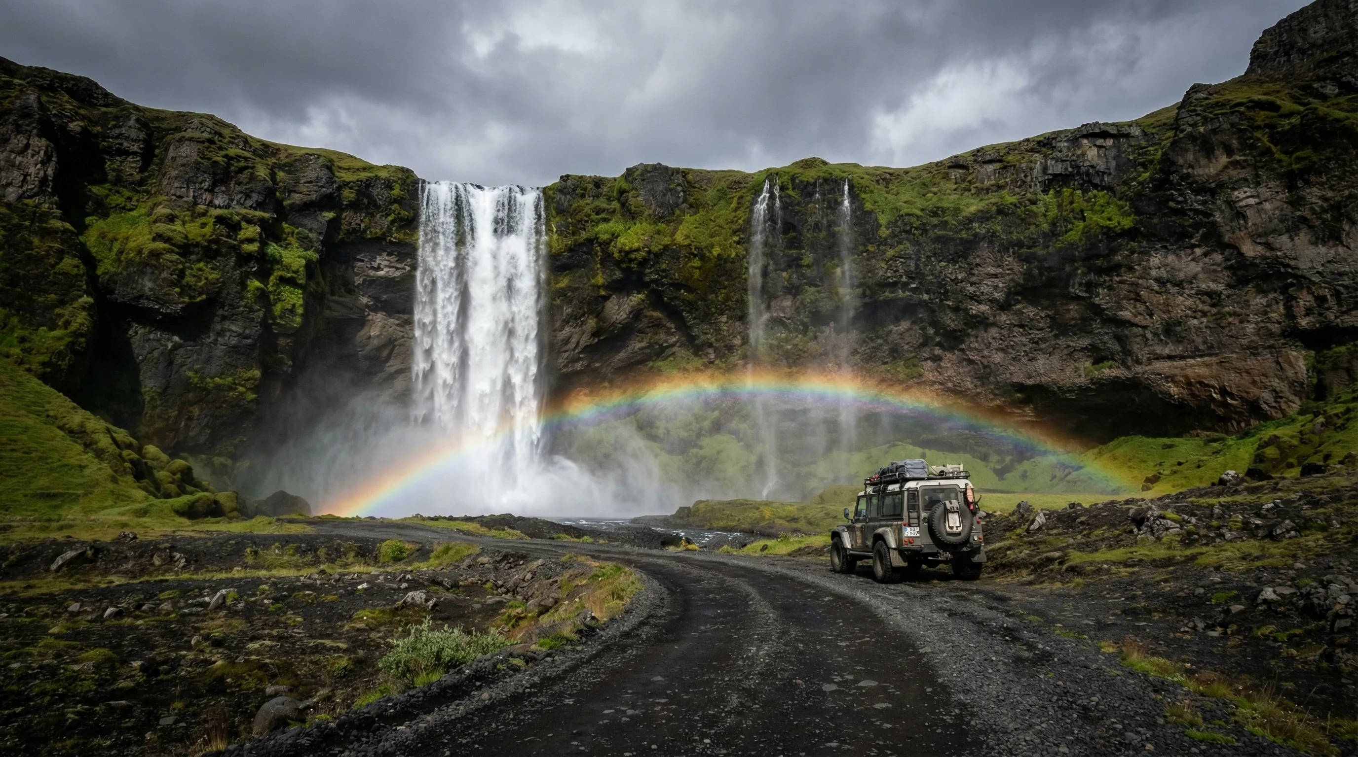
The Ring Road junction is approximately 20 km from Godafoss, the waterfall that anchors the northern tourist circuit. We drove to Godafoss, parked, and walked to the viewpoint. The waterfall was crowded with tourists from the Ring Road who had driven 20 minutes from Akureyri in rental Toyotas. We had driven 200 km through a volcanic desert from the other direction in a vehicle coated in black sand with glacial river water still dripping from the chassis. We felt — and this is as close to smugness as we allow ourselves — that we had earned the view.
Practical information
Vehicle requirements
| Requirement | Detail |
|---|---|
| Drivetrain | 4x4 with low-range (legally required, practically essential) |
| Ground clearance | Minimum 200mm. Higher preferred for river fords. |
| Tires | All-terrain or winter compound. Good tread depth critical for sand traction. |
| Snorkel | Recommended for river fords (not mandatory if crossings are shallow) |
| River fording depth | Vehicle should handle 50 cm comfortably |
| Fuel tank | Minimum 60L recommended. Or carry a jerry can. |
A Toyota Land Cruiser, Mitsubishi Pajero, or similar full-size 4x4 is the correct vehicle for this route. A Suzuki Jimny can complete it in favourable conditions but has less margin for error at deep crossings. Do not attempt in a small 4x4 if the river conditions are anything other than low.
Fuel
| Point | Fuel available | Distance to next fuel |
|---|---|---|
| Hrauneyjar (south start) | Yes | 200+ km (no fuel until north) |
| Nyidalur (midpoint) | No | — |
| Ring Road north junction | No | ~30 km to Akureyri area stations |
Carry a 10L jerry can regardless of tank size. Highland sand driving increases fuel consumption by 30-40 percent compared to ring road estimates. Our Land Cruiser Prado consumed approximately 18 litres per 100 km on this route (versus 12 L/100km on the Ring Road).
River crossing equipment
| Item | Required | Notes |
|---|---|---|
| Waterproof boots (knee-high) | Yes | For walking river crossings to assess depth |
| Tow strap (rated 5+ tonnes) | Yes | For recovery if stuck in a ford |
| Waterproof trousers | Recommended | River assessment gets you wet. Wind makes you cold. |
| Spare dry socks | Recommended | Waterproof boots leak. |
Timing
Start from Hrauneyjar as early as possible. An 8:00 AM departure means you reach the southern fords by approximately 10:00 AM, when water levels are still low from the overnight cooling. An afternoon start means you hit the fords at peak meltwater — deeper, faster, and less forgiving.
| Start time | Southern fords | Nyidalur | Northern fords | Ring Road |
|---|---|---|---|---|
| 8:00 AM | ~10:00 AM (low water) | ~12:30 PM | ~3:00 PM (moderate water) | ~5:00 PM |
| 10:00 AM | ~12:00 PM (rising water) | ~2:30 PM | ~5:00 PM (high water) | ~7:00 PM |
The 8:00 AM start is strongly preferred.
Emergency preparation
There is no mobile coverage on the Sprengisandur route. A satellite communicator (Garmin inReach, Spot, or similar) is strongly recommended. In the event of a vehicle failure, your options are: wait for another vehicle (possible in July-August, when perhaps 10-20 vehicles per day use the route) or activate emergency communications. Walking out is not practical — the distances are too great and the weather too unpredictable.
Carry food for 24 hours beyond your planned driving time. Carry water (3L per person). Carry warm clothing sufficient for an overnight wait in the vehicle. These are not worst-case paranoia — they are standard preparation for a route where help may be hours away.
Environmental rules
Do not drive off the track. Do not drive off the track. Do not drive off the track.
The stakes mark the road. The road is where your wheels go. If you need to stop, pull to the side of the track onto bare sand or rock. Do not park on moss. Do not turn around on moss. If you need to relieve yourself, walk to bare ground.
These are not suggestions. They are legal requirements carrying fines of 500,000+ ISK (3,500+ USD). More importantly, they protect an environment that took centuries to establish and can be destroyed in seconds. The tire tracks in Icelandic moss are visible for 50 years. You do not want to leave that kind of legacy.
From here
Sprengisandur is the central pillar of Iceland’s highland driving. If you have driven it, you are prepared for the Askja caldera track — a more concentrated challenge with deeper river crossings and a volcanic caldera as the destination. If Sprengisandur was your first highland experience and you found it overwhelming, consider stepping back to the Kjolur (F35) for a ford-free highland crossing that builds confidence without the river component. Return to the Iceland hub for the full country overview.