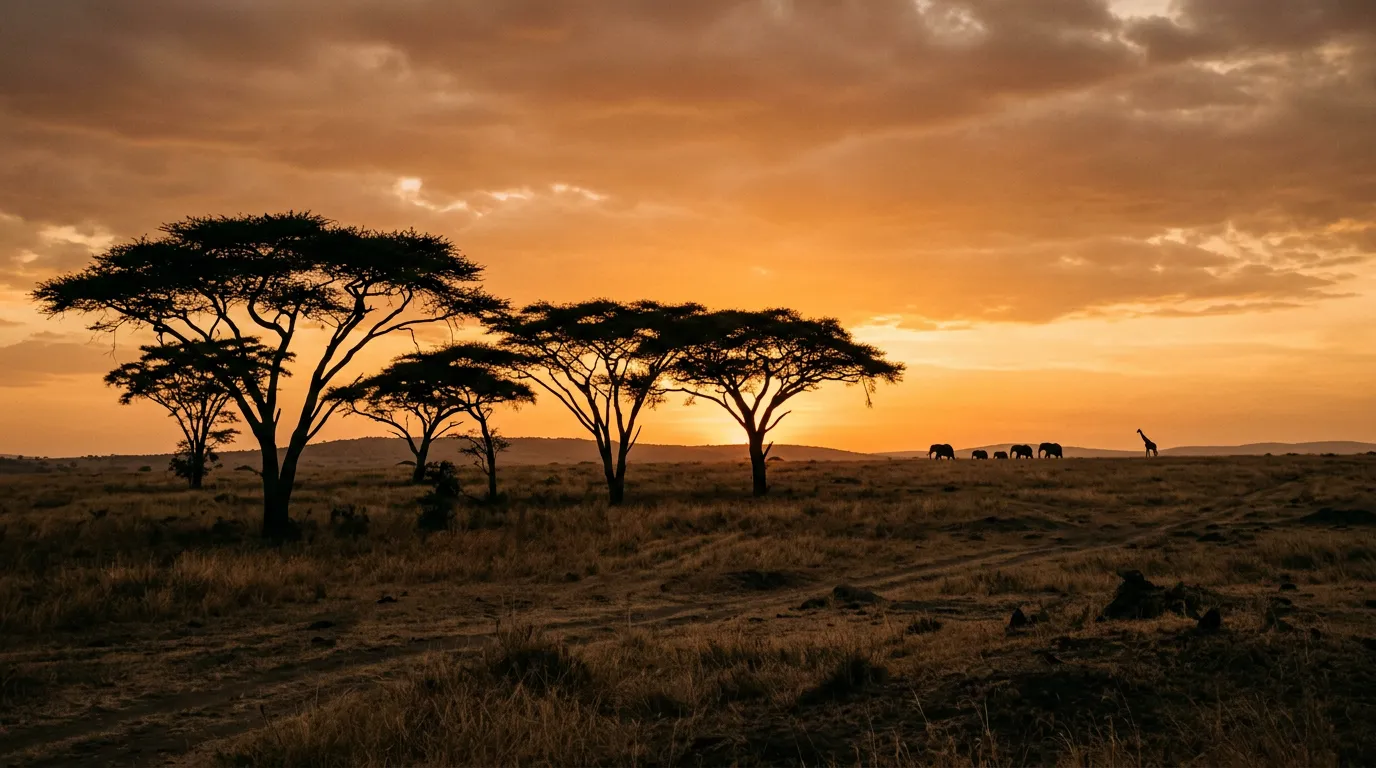
Serengeti Western Corridor
The lioness was lying in the middle of the track. Not beside it, not near it — precisely in the centre, sprawled across both tire ruts with her chin resting on her front paws and her eyes half-closed in the particular expression of a predator that has recently eaten and is digesting in the most inconvenient location available. We stopped the Land Cruiser approximately 15 metres away, switched off the engine, and considered our options. There were no options. The track was bounded on both sides by dense whistling thorn acacia — too thick to drive through, too thorny to appreciate. Behind us, 70 km of savanna track that we had no intention of retracing. Ahead, the lioness. She opened one eye, assessed the vehicle with the practiced disinterest of an animal that has seen thousands of Land Cruisers and found none of them relevant to her concerns, and closed it again.
We sat for forty minutes. Eventually a second safari vehicle approached from the opposite direction, and the combined presence of two diesel engines idling at close range persuaded her to relocate to a shady patch under an acacia approximately five metres off the track. She watched us pass with an expression that conveyed mild disappointment in the human species. This was our introduction to the western corridor, and it set the tone for the next two days: the Serengeti operates on its own schedule, the wildlife treats the roads as their infrastructure (which, in fairness, it is), and the human driver is a guest whose schedule is not a priority.
The Serengeti’s western corridor extends from Seronera — the park’s administrative and tourism hub in the central plains — approximately 130 km west to the Grumeti River and the park boundary near Kirawira. The corridor follows the path of the Great Migration: the annual movement of roughly 1.5 million wildebeest, 400,000 zebra, and 300,000 Thomson’s gazelle from the southern Serengeti calving grounds to the Masai Mara in Kenya. Between June and July, the migration passes through the western corridor, and the Grumeti River crossings — where wildebeest plunge into crocodile-occupied water — are among the most dramatic wildlife events on the planet.
We drove the corridor in late June over two days, camping at a designated site near the Grumeti. This is what we found.
Route overview
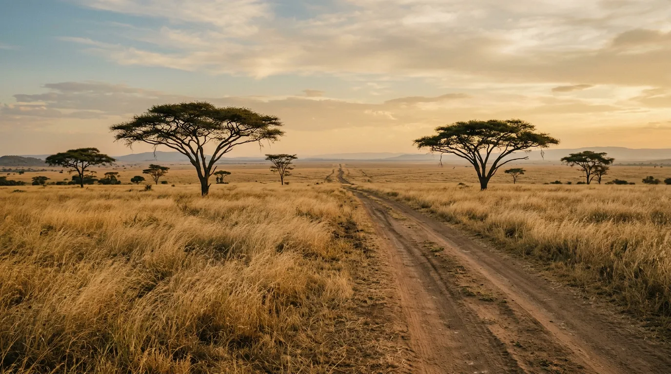
The corridor runs roughly east to west from Seronera to the Grumeti River area. The tracks are not paved, not graded, and not maintained in any way that would suggest a road authority is aware of their existence. They are, however, well-defined — decades of safari vehicle traffic have worn distinct paths through the savanna.
| Section | Distance | Terrain | Key features |
|---|---|---|---|
| Seronera to Grumeti junction | ~50 km | Packed savanna, scattered black cotton | Central Serengeti plains, kopjes (rock outcrops) |
| Grumeti junction to Kirawira camp area | ~45 km | Black cotton soil, river approaches | Dense acacia woodland, big cat territory |
| Grumeti River crossings circuit | ~35 km | Black cotton soil, river banks, soft sand | Migration crossing points, hippo pools, crocodile basking |
Navigation is by GPS waypoint and by following existing tracks. There are occasional signposts — metal poles with hand-painted arrows — but these are unreliable in both existence and accuracy. We used OsmAnd with offline maps and supplemented this with waypoints from a South African overlander’s GPS file that we had downloaded in Arusha. The combination worked well enough that we only made one wrong turn, which led us to a dead end at a hippo pool. There are worse places to make a navigation error.
Seronera to the western plains
Starting point: Seronera (2.4500° S, 34.8333° E)
Seronera is the Serengeti’s central hub: park headquarters, the closest thing to a fuel station, a collection of lodges and campsites, and the junction where the major park tracks converge. The fuel station exists. We want to be precise about this — it is a physical structure with pumps. What it does not always contain is fuel. During our visit in June, the pumps were operational and diesel was available. A guide we spoke to said it had been dry for two weeks in April. Fill your tank completely in Arusha or Karatu before entering the park. If Seronera has fuel, top up regardless of your gauge reading. If it does not, you need a minimum 300 km range to complete the western corridor and return.
The campsite at Seronera is called Seronera Public Campsite, and “public” here means unfenced. Hyenas visited our camp at approximately 2am on the first night. They knocked over a water container, investigated the vehicle’s wheel arches with wet noses, and departed without incident. This is normal. Do not leave food outside the vehicle.
The central plains section
The first 30 km west from Seronera cross the central plains — open grassland dotted with kopjes (granite rock outcrops that rise from the flat savanna like geological afterthoughts). The surface is packed earth and grass, firm and fast in dry season, and the driving is the easiest you will find in the park. Typical speed: 30-35 km/h, limited by the park’s 40 km/h maximum and by the frequency of animal sightings that require stopping.
The kopjes are worth stops. They serve as lookout points for predators — lion prides use them as resting and observation platforms — and the vegetation around their bases often shelters cheetah, serval, and various smaller mammals. Simba Kopjes (named with admirable directness) are a well-known lion spotting location approximately 20 km west of Seronera.
The transition zone
Between 30 and 50 km from Seronera, the terrain changes. The open grassland gives way to scattered acacia woodland, the surface shifts from packed earth to a mixture of packed earth and black cotton soil, and the track becomes less defined. This is the transition zone between the central plains and the western corridor proper.
The black cotton soil appears first in patches — identifiable by its dark colour and cracked surface when dry. These patches are manageable. The vehicle bounces and rattles but maintains traction. The issue is not the dry patches but the knowledge that these patches, in wet conditions, would be vehicle-trapping mires. We drove through them quickly and tried not to think about the forecast.
The black cotton soil problem
We need to talk about black cotton soil because it defines this route.
Black cotton soil — technically “vertisol,” a clay-rich soil with high montmorillonite content — has a unique property: it absorbs water and expands, then shrinks and cracks when it dries. The expansion factor is enormous. A flat, dry surface becomes a sticky, wheel-grabbing swamp after modest rainfall. The soil adheres to everything — tires, chassis, boots, clothing — and builds up in layers that add real weight and pack into wheel arches tightly enough to prevent the wheels from turning.
Black cotton soil condition chart:
| Condition | Surface appearance | Drivability | Action |
|---|---|---|---|
| Dry (3+ days no rain) | Cracked slabs, grey-brown | Rough but passable at 15-25 km/h | Drive normally, expect vibration |
| Drying (1-2 days post-rain) | Tacky surface, some cracks | Marginal. Tires pick up soil | Drive fast enough to maintain momentum |
| Wet (during or just after rain) | Smooth, dark, glistening | Impassable | Do not attempt. Wait or turn back. |
| Saturated (prolonged rain) | Standing water, black slurry | Completely impassable | Route is closed. No exceptions. |
During our visit the soil was in “dry” to “drying” condition. We maintained momentum, avoided stopping on black cotton sections, and used the tire tracks of previous vehicles wherever possible. The experience was uncomfortable but never dangerous. A week earlier, according to a guide at Kirawira, a self-drive vehicle had sunk to its axles on the same section and required a TANAPA rescue vehicle — a process that took 14 hours.
Tire pressure on black cotton: we ran 22-25 PSI, slightly deflated from normal road pressure. Full deflation as used in sand driving does not help here — the soil is not sand. What helps is momentum and a prayer that the surface is dry enough to support your vehicle’s weight.
The Grumeti corridor
Kirawira and big cat territory
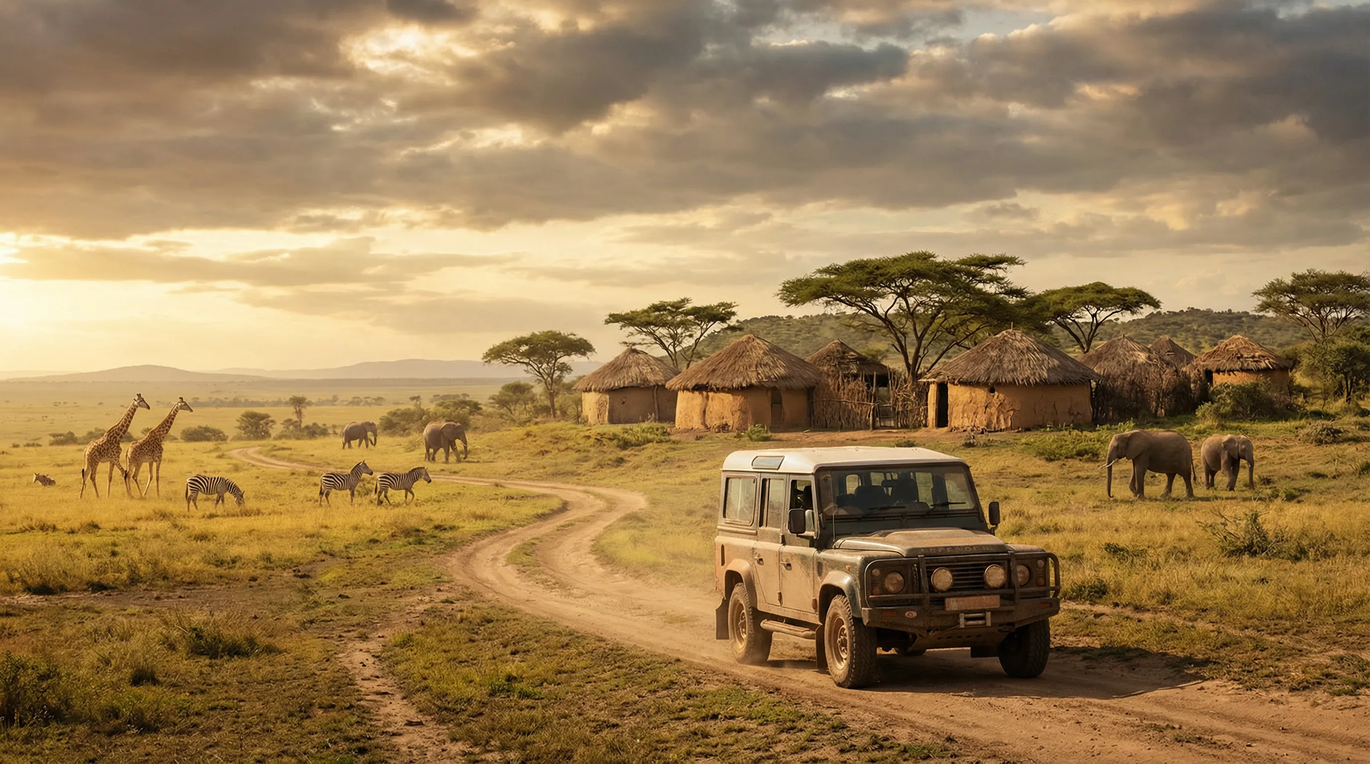
West of the transition zone, the corridor enters the Grumeti area — denser woodland, more watercourses, and a wildlife density that increases markedly as you approach the river. This is big cat territory. The Kirawira area supports a resident lion population that hunts along the woodland edges, and the acacia scrub provides ideal stalking cover for leopard. We saw three lions within the first 10 km of this section — two males resting under a tree and a female moving through the grass approximately 200 metres from the track with the focused purposefulness of a predator on a mission.
The track through Kirawira is narrower than the central plains tracks — single-vehicle width in places, with acacia branches close enough to scrape the vehicle’s flanks. Drive with mirrors folded or accept scratches. The surface alternates between black cotton soil (dominant) and patches of harder ground where rocky substrate breaks through.
Approaching the Grumeti River
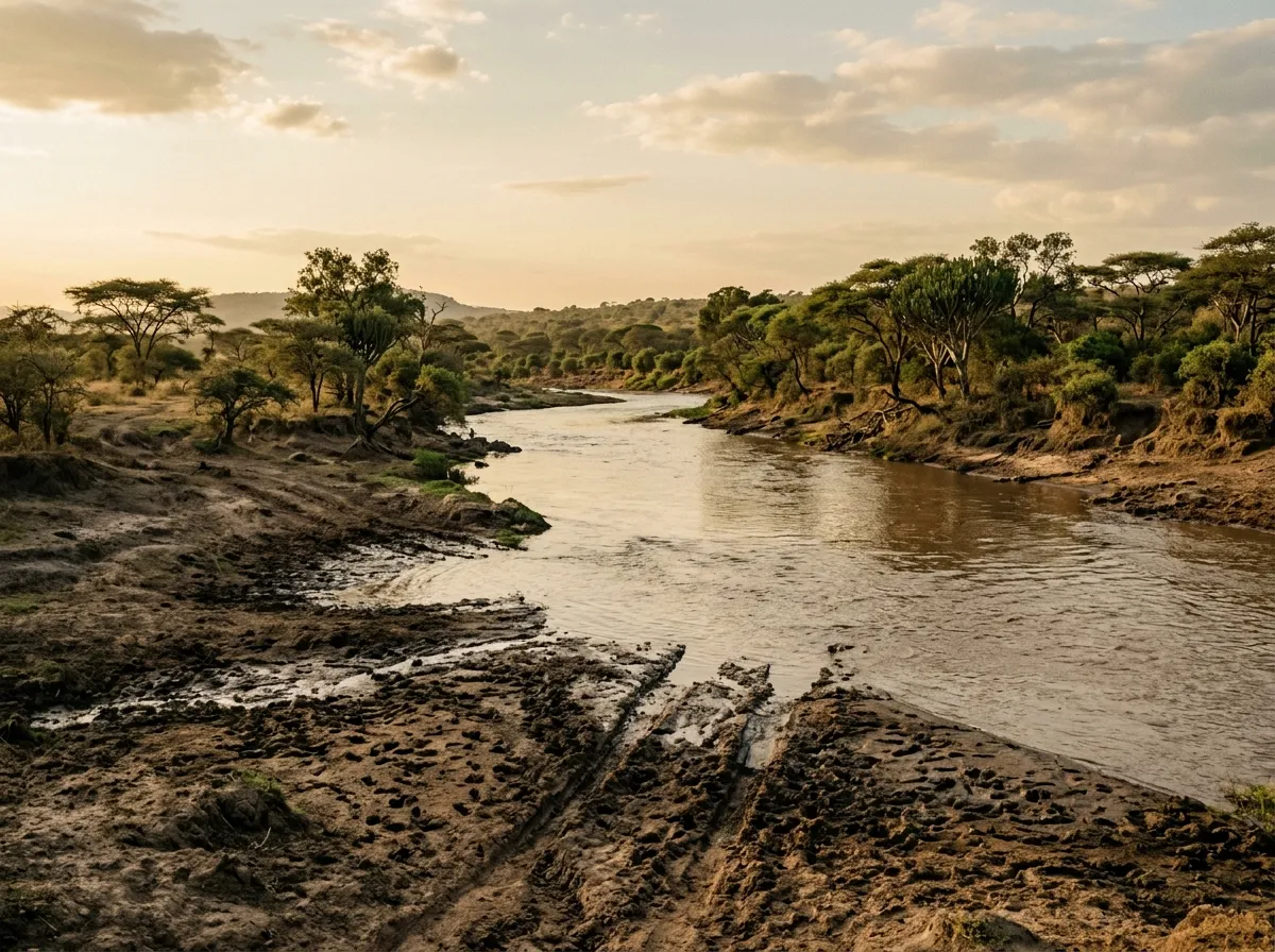
The Grumeti River is the western corridor’s destination and its most significant obstacle. The river runs roughly north-south, crossing the migration path, and the crossing points — both for wildebeest and for vehicles — are concentrated in a section approximately 15 km long.
The vehicle crossing points (which are different from the wildebeest crossing points for obvious reasons) are marked by concrete ramps on each bank. “Concrete” is optimistic — they are partially deteriorated structures that serve mainly to indicate where previous vehicles have crossed. The river depth varies with season: ankle-deep in late dry season, waist-deep in early dry season, and do-not-attempt during the rains.
Grumeti River crossing assessment protocol:
- Stop the vehicle well back from the bank.
- Walk to the crossing point. Assess the water depth visually.
- Find a long stick. Wade into the crossing. Measure depth at the deepest point.
- If depth exceeds 50 cm: do not cross. The river bottom is uneven and a reading of 50 cm at the edge can mean 80 cm in the channel.
- If depth is below 50 cm: cross in low-range, second gear, at a steady pace. Do not stop in the water.
- On the far bank: check underneath the vehicle for debris caught on the chassis.
We crossed at a point where the depth was approximately 35 cm — comfortable for our Land Cruiser’s clearance but enough water to require attention. The river bottom was firm gravel, which was a relief after the black cotton soil.
The migration
We need to state this plainly: if you are driving the western corridor in June or July and you encounter the migration, the experience will reorder your understanding of what the natural world is capable of. The numbers — 1.5 million wildebeest — are abstract until you are sitting in a stationary vehicle while a column of animals crosses the track in front of you, behind you, and alongside you in a stream that takes twenty minutes to pass. The sound is constant: hooves, grunting, the strange nasal vocalisation that wildebeest use to communicate, and underneath it all the low rumble of thousands of animals moving across the earth.
The Grumeti River crossings are the climax. The wildebeest gather on the north bank — sometimes in herds of thousands, milling and jostling at the water’s edge — and then, triggered by a mechanism that no biologist has satisfactorily explained, they pour into the river. The Grumeti crocodiles, some of which are five metres long and have spent the entire year waiting for this moment, are present at the crossing points. We watched from the vehicle — the crossing points are visible from the track, approximately 100-200 metres from the standard viewing positions. The binoculars earned their weight.
Not every visit coincides with a crossing. The migration timing varies by weeks, and the wildebeest choose their crossing points based on factors that do not include the human calendar. We were fortunate. The guides at Kirawira track the migration movement daily and can advise on whether crossings are likely.
Camp logistics
Designated campsites
The western corridor has two public campsite areas: one near Kirawira and one further south near the Grumeti junction. Neither has facilities beyond a flat area designated for tents. There are no showers, no toilets (bring a portable system or a shovel and appropriate distance from water sources), no water supply, and no fencing.
The lodge options — Kirawira Serena and Grumeti Serengeti — are upmarket, fully serviced, and priced at $500-1,500 per person per night. We camped.
Camping in lion country
The standard advice for camping in areas with large predators is: stay in the vehicle after dark, keep food locked in the vehicle, make noise when moving around camp, and carry a strong flashlight. We followed all of this and can add the following observations:
Lions are not interested in tents or the people inside them. They are interested in food smells and in the sounds of distressed animals. Do not cook meat at your campsite (we ate cold food both nights). Do not leave the vehicle to investigate sounds at night — the sounds are hyenas, and they are investigating you.
The hyenas arrived both nights. They are persistent, intelligent, and capable of opening vehicle doors if the handles are the push-button type. Lock everything. They chewed the rubber seal on our spare tire carrier and investigated the exhaust pipe with their noses. At no point were we in danger, but the experience of lying in a roof tent listening to something large sniffing the vehicle’s undercarriage below you is one that stays with you.
Equipment checklist
| Item | Required | Notes |
|---|---|---|
| 2 spare tires | Yes | Thorn punctures are near-guaranteed. We used both spares. |
| High-lift jack | Yes | Standard jacks sink into soft soil. The high-lift is essential. |
| Recovery boards (pair) | Yes | For black cotton soil extraction |
| Tire compressor (12V) | Yes | Pressure adjustment for varying surfaces |
| Thorn-proof tire sealant | Yes | Preventive measure — inject before entering the park |
| Satellite phone or communicator | Yes | No mobile coverage in the western corridor |
| 40L extra water | Yes | 5L per person per day minimum, plus vehicle cooling reserve |
| 40L extra fuel | Yes | Seronera fuel station is unreliable |
| Tow strap (5-tonne rated) | Recommended | For mutual recovery with other vehicles |
| Binoculars (10x42 or similar) | Recommended | Migration crossings are viewed at distance |
| Portable toilet | Recommended | No facilities at campsites |
Fuel and water logistics
Our Toyota Land Cruiser consumed 22 litres per 100 km on the western corridor tracks — significantly more than its 14L highway figure. The increase is due to sustained low-speed 4x4 driving, frequent stops and starts (wildlife on the track), and air conditioning that was not optional at 35 degrees Celsius. On 130 km of corridor tracks plus the return to Seronera, we burned approximately 60 litres. With a 90-litre main tank and a 20-litre jerry can, we had margin, but a vehicle with a smaller tank would need more reserve fuel.
Water: we carried 40 litres for two people over two days. We used approximately 25 litres (drinking, cooking, minimal washing). The heat in the corridor is substantial — direct equatorial sun on open savanna — and dehydration creeps up on you faster than you expect.
Seasonal and weather considerations
The western corridor is a dry-season route. We cannot state this strongly enough: do not attempt it during the rains. The black cotton soil will stop you, and recovery in a remote section of the Serengeti can take days, not hours. TANAPA may close the western corridor during particularly wet periods — check at Seronera headquarters before departing.
| Month | Conditions | Migration status | Recommendation |
|---|---|---|---|
| January – February | Short dry, variable | Southern calving grounds | Possible but risky. Check conditions daily. |
| March – May | Long rains | Migration moving north | Do not attempt. Route likely impassable. |
| June – July | Dry season, optimal | Migration in western corridor | Best time. Book ahead — guides and camps are busy. |
| August – September | Dry season, optimal | Migration in northern Serengeti/Mara | Good driving, less wildlife in corridor |
| October | Late dry, possible short rains | Migration returning south | Check forecasts. Rain can start early. |
| November – December | Short rains | Southern Serengeti | Do not attempt. |
Getting there
From Arusha: Drive to Ngorongoro Gate via Karatu (approximately 250 km, 5-6 hours on paved road). Enter the park via Naabi Hill Gate on the southern boundary (additional 100 km from Karatu through the Ngorongoro Conservation Area). From Naabi Hill to Seronera: 75 km on park tracks, approximately 2-3 hours. Total from Arusha to Seronera: 8-10 hours driving.
From Karatu (recommended starting town): Fill fuel tank completely. Stock water and supplies — Karatu has supermarkets and a reasonable outdoor equipment shop. Drive to Ngorongoro Gate (35 km), pay NCA and Serengeti fees, continue to Seronera.
The Serengeti Western Corridor connects well with Ngorongoro Rim Tracks — the crater is on the direct route between Karatu and the Serengeti. For a two-week Tanzania itinerary, combine both with Ruaha River Crossings, adding a transfer day between the northern and southern parks.
The honest summary
The Serengeti Western Corridor is not a casual drive. It requires a properly equipped 4x4, genuine off-road preparation, and a willingness to be uncomfortable in exchange for experiences that cannot be replicated from the window of a guided safari vehicle. The black cotton soil will test your patience. The logistics will test your planning. The wildlife — the sheer scale and density and unapologetic presence of it — will remind you why you drove 10,000 km to be here.
We have driven in 13 countries across four continents, and the western corridor remains one of the most extraordinary drives we have completed. It is not the most technically difficult. It is not the most scenically dramatic. But it is the one where the landscape is most visibly, unarguably alive, and where the act of driving through it feels less like transportation and more like participation.
Bring spare tires. Bring water. Check the soil.