Albanian Riviera Coastal Tracks
The Albanian Riviera is not a secret anymore. The main road — the SH8 from Vlora to Saranda — is paved, busy, and peppered with package-holiday hotels that would look at home in Kos or Bodrum. But the coastline itself, the actual rock-and-water edge of it, remains accessed primarily by dirt tracks that drop from the highway to beaches the tour buses cannot reach. These are the roads we drove.
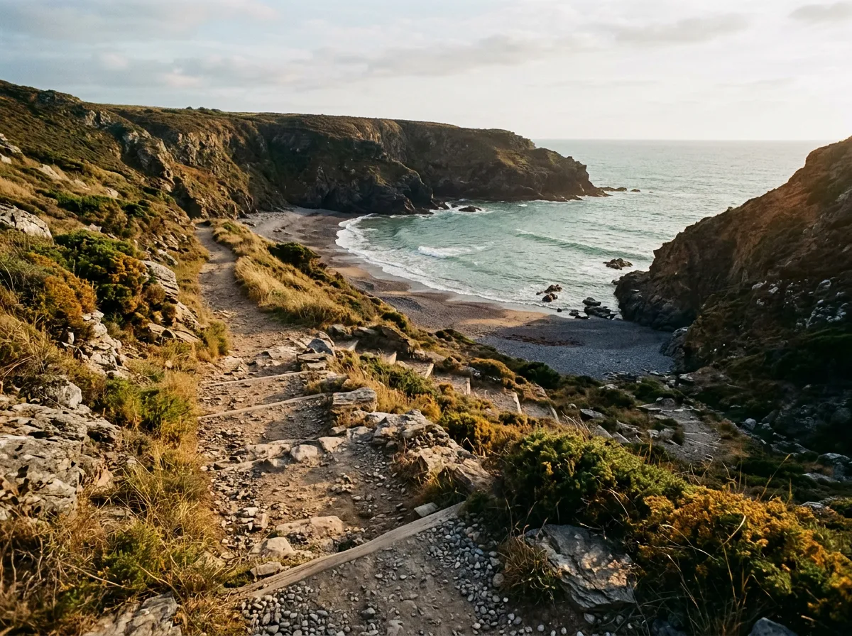
There is a particular pleasure in descending a gravel track to a beach where there are zero sunbeds, zero bars, zero people — and the water is that shade of blue-green that photographs never quite capture because it looks too saturated to be real. The Albanian Riviera delivers this repeatedly. The catch is that you have to earn it. The tracks are steep, the surfaces are loose, and the clearance requirements are genuine. A sedan will not survive the descent to Gjipe. A Dacia Duster will, but with careful line selection and a willingness to hear your skid plate earn its name.
We drove this route over two days in August 2023, starting from Dhermi and ending near Lukove, with multiple beach detours and one unplanned overnight when we decided that the cove at Llamani was too good to leave. Total driving distance on unpaved surfaces: approximately 95 km. Total time spent in the water: approximately as much.
Route overview
The route follows a loose north-to-south trajectory along the coast between Dhermi and Kakome Bay, south of Lukove. It is not a single continuous track — it is a collection of connected segments that branch off the paved SH8 to reach beaches, viewpoints, and clifftop villages. You can drive the whole sequence in a day if you resist the temptation to swim at every stop, but spreading it across two days is more honest about your actual intentions.
| Segment | Distance | Terrain | Difficulty | Notes |
|---|---|---|---|---|
| Dhermi to Jale clifftop road | 12 km | Exposed gravel, some rock | Moderate | Views to Corfu on clear days |
| Gjipe Beach access track | 4 km (one way) | Rocky descent, steep | Moderate | Return climb is the challenge |
| SH8 connector to Himara | 15 km | Paved | Easy | Fuel and supplies stop |
| Himara to Livadhi Beach | 8 km | Gravel and dirt | Easy | Good surface, gentle grade |
| Porto Palermo to Llamani | 6 km | Rocky track, narrow | Moderate | Last 1.5 km is rough |
| Lukove to Kakome Bay | 18 km | Gravel through olive groves | Moderate | Abandoned military base at the end |
| Various beach access spurs | 3-5 km each | Steep, loose rock | Moderate-Challenging | Assess individually |
GPS coordinates for the start point (junction off SH8 near Dhermi): 40.0750 degrees N, 19.8017 degrees E. End point (Kakome Bay track junction): 39.7800 degrees N, 20.0050 degrees E.
Day 1: Dhermi to Himara
The Dhermi clifftop traverse
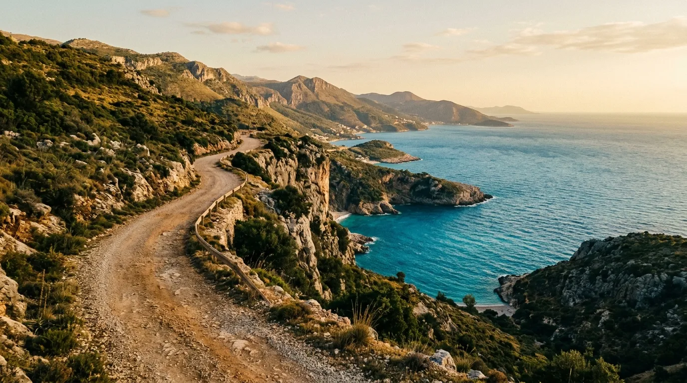
The first section sets the tone. From the SH8 junction above Dhermi, a gravel road drops toward the coast and then contours along the clifftop, staying between 200 and 400 metres above sea level. The surface is compacted gravel with occasional rock outcrops — nothing technically demanding, but the exposure is the thing. The road is single-lane with passing places. The seaward side has no barrier of any kind. On a clear day, Corfu floats in the haze across the strait, and the water below is a colour that probably has a name in Greek but we do not know it.
The road connects several small settlements and guesthouses. The locals drive it in front-wheel-drive compacts, which tells you something about the surface quality — it is the steeper side-tracks to the beaches below that require clearance.
Gjipe Beach descent
The Gjipe Beach track is the signature detour of this section. It leaves the clifftop road at approximately 40.0417 degrees N, 19.8333 degrees E and descends 350 vertical metres in 4 km to one of Albania’s most photogenic beaches — a white gravel cove at the mouth of Gjipe Canyon, walled in by limestone cliffs.
The track is one-lane throughout, carved into the hillside with exposed rock surface, loose gravel sections, and a gradient that averages about 12 percent. A high-clearance 2WD can descend in dry conditions if driven carefully. The issue is the return. Climbing out on loose gravel with a loaded vehicle is where category 2 vehicles start to struggle — spinning wheels on the steeper bends, undercarriage contact on the rock ledges. We managed it in a Duster but wished we had 4WD for the last kilometre of the ascent.
The beach itself has no permanent facilities. A seasonal bar operates from a shipping container in summer months. No toilets, no shade structures, no fresh water on the beach. The canyon behind the beach is worth the walk — a narrow limestone slot that extends several hundred metres inland.
Afternoon on the Jale road
South of the Gjipe junction, the clifftop road continues to the village of Jale, where a handful of guesthouses perch above a long gravel beach. The road surface improves here — wider, better graded, and with a few concrete patches on the steepest sections. The descent to Jale beach is manageable in any vehicle with clearance.
From Jale, the coast road becomes intermittent — some sections have been improved, others peter out into footpaths. We rejoined the SH8 and drove the 15 km to Himara on pavement. Himara has fuel stations, ATMs, supermarkets, and restaurants. It is the logical resupply point.
Day 2: Himara to Kakome Bay
Porto Palermo and Llamani Beach
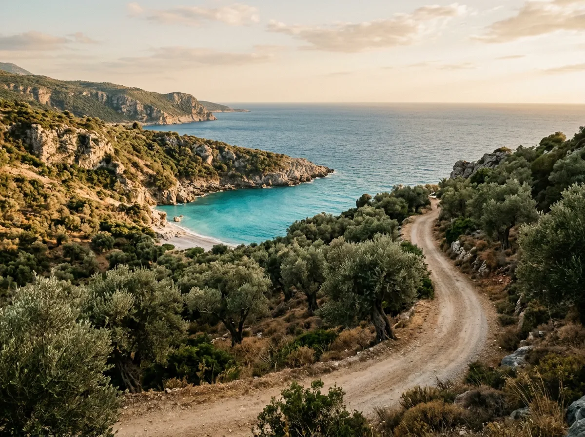
South of Himara, the SH8 passes Porto Palermo — an Ottoman-era fortress on a small peninsula that is worth a 20-minute stop if you have not seen it before. From the fortress parking area, a track leads south along the coast toward Llamani Beach. The first 4 km are reasonable gravel. The last 1.5 km deteriorate to a rocky track that narrows to single-vehicle width with no turning space.
Llamani is a small gravel cove backed by maquis scrub. There are no facilities. The water is deep, clear, and cold by Albanian standards — which is to say, still warmer than anything in northern Europe. We arrived at 9:00 and left at 16:00, which tells you what kind of beach this is. The return climb to the SH8 takes about 20 minutes at walking pace.
The Lukove coastal tracks
Between Himara and Saranda, the coast becomes less dramatic but the track network expands. The village of Lukove sits above the coast with gravel roads leading to several beaches — Shpella, Pasqyra, Kakome. These tracks wind through olive groves on moderate grades, and the surfaces are generally better than the northern sections. A high-clearance 2WD handles all of them in dry conditions.
The Kakome Bay track is the longest of the Lukove detours — 18 km from the SH8 junction to the coast. The destination is an abandoned Albanian navy base from the communist era, now slowly being consumed by vegetation and salt air. The bay itself is ringed by low hills, the water is sheltered, and the military infrastructure provides unintentional shade structures. It is a strange, atmospheric place.
Fuel and logistics
| Item | Detail |
|---|---|
| Fuel | Himara: multiple stations. Saranda: multiple stations. No fuel on the coast tracks themselves |
| Water | Carry 2L per person per beach stop. No reliable fresh water at remote beaches |
| Mobile coverage | Intermittent on coastal tracks. Reliable in Himara and at high points |
| Accommodation | Dhermi, Himara, Lukove all have guesthouses. Beach camping is tolerated but technically illegal |
| Food | Himara supermarkets for supplies. Beach restaurants are seasonal and unreliable |
Vehicle notes
The coastal tracks themselves are mostly manageable in a high-clearance 2WD like the Dacia Duster. The beach access spurs are the crux. Each one needs individual assessment — get out of the vehicle at the top and walk the first 200 metres to gauge the grade and surface before committing. Reversing back up a steep, narrow, loose-surface track is never enjoyable and sometimes not possible.
We drove the entire route in a Dacia Duster 4x4 and were grateful for the 4WD on three specific occasions: the Gjipe Beach return climb, a muddy section of the Llamani approach after overnight rain, and a sandy patch on the Kakome Bay track. Could we have managed in 2WD? Probably. Would we have been more stressed? Certainly.
Tire pressure: we ran 1.8 bar on the gravel tracks and dropped to 1.5 bar on the rockier beach access spurs. The surface is abrasive — limestone and flint — so check your tires at every stop for cuts. We picked up a sidewall nick on the Gjipe track that held air but made us nervous for the remaining 60 km.
Practical details
Start point: SH8 junction above Dhermi (40.0750 degrees N, 19.8017 degrees E). Coming from Vlora, cross Llogara Pass and descend 15 km on the paved SH8.
End point: Kakome Bay track junction south of Lukove (39.7800 degrees N, 20.0050 degrees E). From here, it is 30 km of paved road to Saranda.
Season: May through October. July and August are hot and the popular beaches (Gjipe, Jale) attract foot traffic, though vehicle access keeps the crowds manageable. September is the best month — warm water, fewer people, stable weather.
Maps: OsmAnd has the most complete track data for this area. Google Maps shows some of the tracks but not all. Download offline maps before leaving Tirana or Saranda.
Cost: No tolls, no entry fees, no permits. Budget for fuel (approximately 20 EUR for the full route), water, and food. Guesthouses in Dhermi and Himara range from 25-50 EUR per night.
Connections
This route pairs naturally with the Llogara Pass tracks, which you pass through on the way from Vlora. For a longer Albanian itinerary, drive the coast first (warm-up), then head north for Valbona to Theth (the main event). Return to the Albania hub for the full country overview.
If the Albanian Riviera’s combination of coastal driving and swimming appeals to you, the Montenegrin coast offers a paved version — less adventurous but more scenic per hour of driving. The closest equivalent in our catalog is the coastal section of the Prokletije Border Trail, which shares the Albanian border’s raw character but at higher elevation.