Jebel Akhdar Mountain Road
The police officer walked around the vehicle, checking each wheel. He crouched, looked underneath at the transfer case, stood up, examined the tires, and then asked us to engage the four-wheel drive system. The dashboard lights came on — front and rear axles locked, low-range engaged. He nodded. “OK, you can go.” The entire interaction took about ninety seconds and was conducted with the casual efficiency of someone who does this hundreds of times a day, because he does. The Jebel Akhdar checkpoint is one of the few places on Earth where police routinely inspect vehicles for mechanical capability rather than legal compliance. If your vehicle does not have four-wheel drive, you are not going up the mountain. This is not a suggestion or a guideline. It is policy, and the officer at the barrier will enforce it with a politeness that does not mask the complete absence of negotiation.
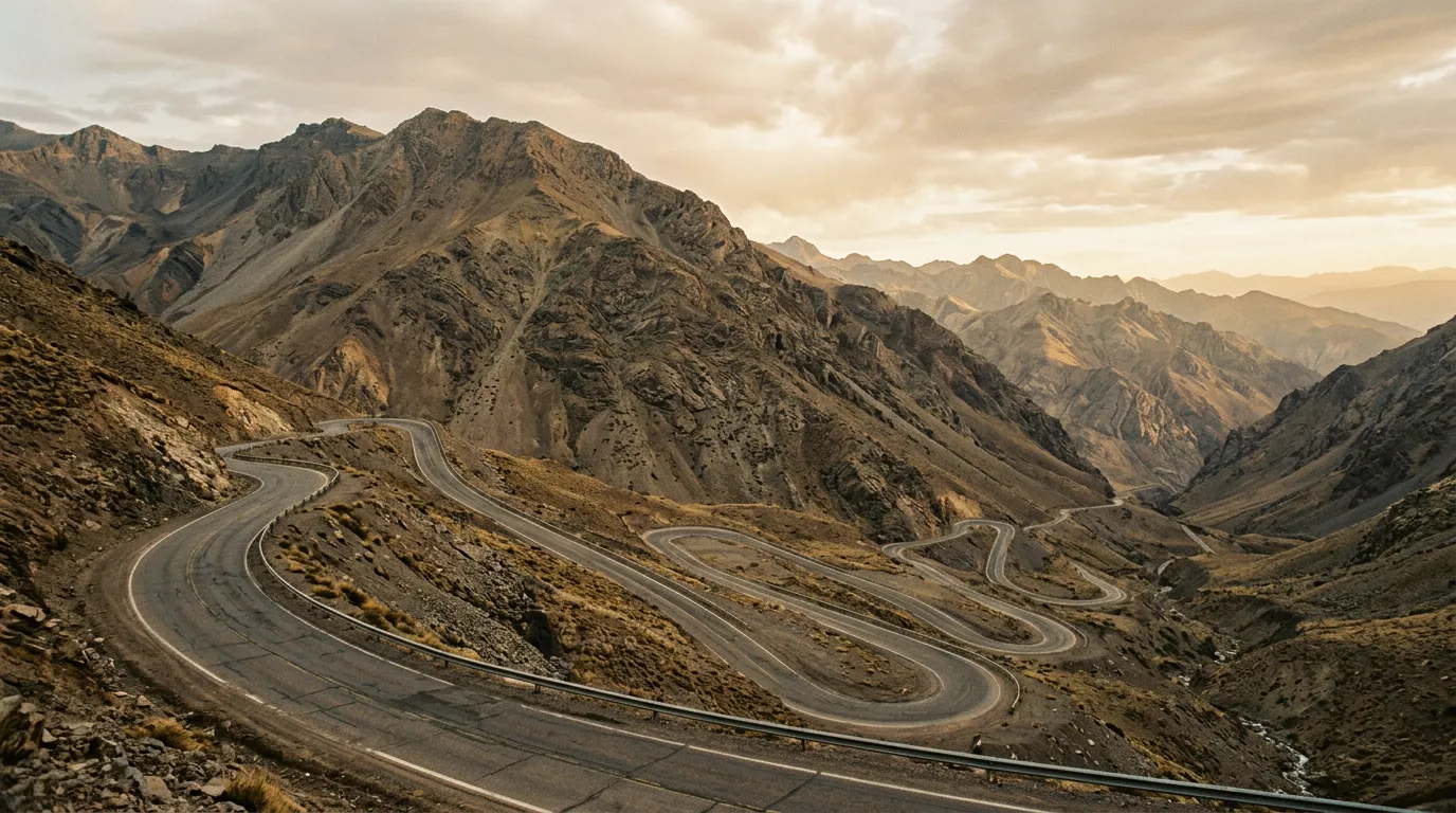
The reason becomes clear about fifteen minutes into the climb. The road gains 1,400 metres of elevation in 45 km, via a sequence of switchbacks, hairpins, and traverses carved into the flank of the Al Hajar Mountains. The gradient is continuous and relentless. A 2WD vehicle with a loaded car would overheat, lose traction on the steeper gravel-edged sections, or both. The Omani police know this because they have presumably seen the results, and their solution — a checkpoint with a practical test — is the most sensible approach to mountain road safety we have encountered anywhere.
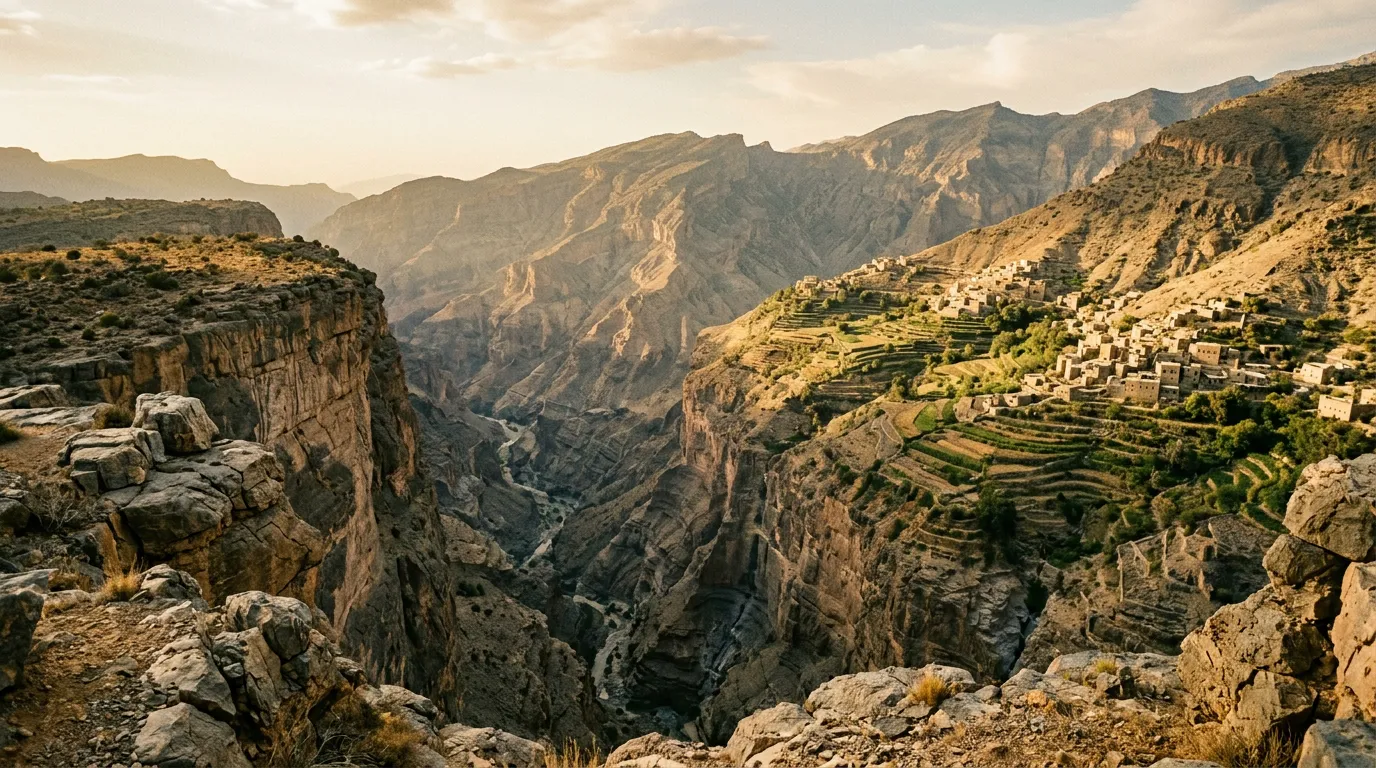
Jebel Akhdar means “Green Mountain” in Arabic, which seems implausible when you begin the climb through the barren, sun-blasted foothills south of Nizwa. It makes complete sense when you arrive at the 2,000-metre plateau and find terraced rose gardens, pomegranate orchards, walnut groves, and temperatures that are 15 degrees cooler than the Omani coast. The mountain traps moisture from the rare rain events and distributes it through an ancient falaj (irrigation channel) system that has supported agriculture here for at least 4,000 years. The result is a pocket of green in a country of brown and gold — an altitude-defying oasis that feels as though it was transplanted from somewhere more temperate.
We drove the road in a half day, climbing from Birkat al Mawz at the mountain’s base to the Sayq plateau at the summit, with stops at the viewpoints and villages along the way. This guide covers the drive and the plateau.
Route overview
| Section | Distance | Elevation | Terrain | Time |
|---|---|---|---|---|
| Birkat al Mawz to checkpoint | ~5 km | 600m to 650m | Paved, flat | 10 min |
| Checkpoint to mid-mountain viewpoint | ~15 km | 650m to 1,200m | Paved switchbacks, steep | 40 min |
| Mid-mountain to Sayq plateau | ~15 km | 1,200m to 2,000m | Paved, continuous climb | 35 min |
| Sayq plateau exploration | ~10 km | 1,900m to 2,000m | Paved, narrow village roads | 1-2 hours |
Total: approximately 45 km one-way, 3-4 hours including stops. The return descent takes about 1.5 hours.
Getting to the base
Birkat al Mawz (23.1500° N, 57.3000° E)
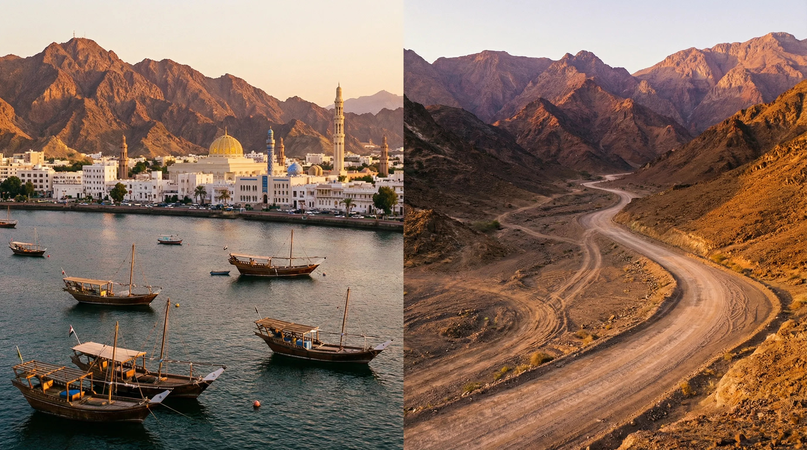
The mountain road begins at Birkat al Mawz, a small town at the base of the Al Hajar range, about 40 km southwest of Nizwa on Route 21. Nizwa is the usual base for Jebel Akhdar — it has fuel, hotels, restaurants, and the 17th-century Nizwa Fort, which is worth a visit if you have a spare hour.
Birkat al Mawz itself has two things worth noting: the ruins of Bait al Rudaydah (a restored fortified plantation house with falaj channels running through it), and the fact that it is the last fuel before the mountain. Fill your tank in Nizwa or Birkat al Mawz — the round trip to the summit and back is about 90 km, which is not a fuel concern for any modern vehicle, but the mountain road uses more fuel than the distance suggests. Our vehicle consumed about 16L/100km on the climb (versus its normal 12L/100km on flat roads), which is typical for sustained low-speed, high-load mountain driving.
The checkpoint
The police checkpoint is located approximately 5 km up the road from Birkat al Mawz, at the point where the road narrows and begins the serious climbing. The officers will:
- Check that your vehicle has 4x4 capability (they know what to look for — transfer case, differential lock indicators, etc.)
- Ask you to demonstrate 4WD engagement (turn on the system, show the dashboard lights)
- Wave you through
The process takes 1-2 minutes and is conducted in English without difficulty. There is no fee, no permit, and no paperwork. You do not need to pre-register. You just need a 4x4.
What does not pass: Standard 2WD rental cars, 2WD SUVs (some vehicles look like 4x4s but are not), vehicles with bald tires or obvious mechanical issues. The officers are experienced enough to spot the difference between a genuine 4x4 and an aesthetic one.
What passes: Any vehicle with functional four-wheel drive. We saw Suzuki Jimnys, Toyota Land Cruisers, Nissan Patrols, Mitsubishi Pajeros, and a Jeep Wrangler go through while we were there. The officers do not care about the brand — they care about the drivetrain.
The climb
Lower section: Checkpoint to mid-mountain (15 km)
The first 15 km above the checkpoint are the steepest and most winding section of the road. The gradient averages 8-10% with sections of 12-15%. The road is paved and maintained, but the surface has gravel shoulders that narrow the effective driving width, and the turns are tight enough that you need to use the full lane on some hairpins.
The terrain is bare rock — grey-brown limestone and dolomite, folded and faulted by the tectonic forces that built the Al Hajar range. Vegetation is almost completely absent. The exposure is total — the sun reflects off the rock faces and the temperature inside the vehicle can spike if your air conditioning is struggling with the combination of heat, gradient, and altitude.
The switchbacks offer views back down to the plain below, and by the 10 km mark you can see Birkat al Mawz as a green patch in the brown landscape, surprisingly far below. The sense of vertical gain is more pronounced here than on most mountain roads we have driven — the terrain is so barren that there is nothing to distract from the fact that you are climbing very steeply through very empty space.
Upper section: Mid-mountain to the plateau (15 km)
At approximately 1,200 metres, the road enters a different landscape. The gradient eases slightly, the switchbacks become broader, and the first signs of vegetation appear — scattered juniper trees, wild olive, and tufts of grass in the rock crevices. The rock colour shifts from grey-brown to a warmer ochre as different geological formations are exposed.
At about 1,500 metres, the road passes through a section of wadi terraces — old agricultural land built on the mountain flanks using stone retaining walls and falaj channels that bring water from springs higher up. Some of these terraces are still farmed; others are abandoned, their walls slowly crumbling back to the mountain.
The final kilometres to the plateau are less steep but more winding, as the road traverses across the head of a major canyon (the Grand Canyon of Oman — Wadi Nakhr — is visible to the west on clear days, though it is accessed via a different road from Jebel Shams rather than Jebel Akhdar).
The Sayq Plateau
Arriving at the top
The plateau arrives abruptly. You come around a final turn and the barren mountainside is replaced by — green. Terraced gardens. Stone-walled orchards. Rose bushes in neat rows. Pomegranate and walnut trees heavy with fruit in season. The temperature drops by 10-15 degrees compared to the base, and the air carries a faint sweetness that, in March and April, is the Damask rose harvest for which Jebel Akhdar is famous.
The Sayq plateau is not large — the settled area covers perhaps 10 km of interconnected villages and agricultural terraces — but it is intensely cultivated. The falaj system, which is UNESCO-listed (as part of Oman’s broader falaj heritage), channels water from mountain springs to the terraces through stone channels that have been maintained for millennia. The system is still operational, and you can follow the channels from village to village.
The villages
Several villages are scattered across the plateau, connected by narrow paved roads that barely accommodate a single vehicle. The architecture is traditional Omani mountain style: stone houses with flat roofs and small windows, built to retain heat in winter (the plateau freezes on winter nights) and stay cool in summer. The villages are quiet, inhabited year-round, and welcoming to visitors — we were offered coffee and dates at a small shop in Al Ayn village without any suggestion of commercial transaction.
Al Ayn is the most accessible village, with a small parking area and walking paths through the rose terraces. During the rose harvest (March to April), the village is the centre of rose water production — the petals are distilled in traditional copper stills, and the resulting rose water is sold locally and in Nizwa.
Sayq is the largest settlement, with a few shops, a telecommunications tower, and the Anantara Al Jabal Al Akhdar resort, which occupies a dramatic position on the canyon rim. The resort is expensive (200+ OMR per night) but its restaurant is open to non-guests and the terrace view is worth the price of a coffee.
Diana’s Point (23.0750° N, 57.3200° E)
Diana’s Point is a viewpoint on the canyon rim named after Princess Diana, who reportedly visited in the 1980s. The view is a 1,000-metre vertical drop into the canyon below — a sheer wall of layered rock descending to the wadi floor, with the terraced villages of the opposite wall visible across the gap. It is one of the most dramatic viewpoints in Oman and access is straightforward — a short walk from a parking area near the Anantara resort.
The viewpoint has no barrier or railing. The edge is a rock ledge with nothing between you and the canyon floor. This is not unusual in Oman (the country takes a refreshingly non-litigious approach to natural hazards) but it demands respect. Do not approach the edge in wind, in rain, or in anything other than full awareness of where your feet are.
The descent
The descent is the climb in reverse, which means the gradient that demanded engine power on the way up now demands engine braking on the way down. Engage 4WD low-range and use engine braking through the switchbacks — the same protocol as any mountain descent, and the same consequences (brake fade, overheating) if you rely on the brake pedal instead.
The descent takes about 1.5 hours. The afternoon light is better for photography on the way down — the western-facing slopes catch the warm light that the morning climb misses.
Practical details
What to bring
| Item | Notes |
|---|---|
| Warm layer | 15°C cooler than the coast. Mountain mornings can be genuinely cold (5-10°C in winter). |
| Water (2L per person) | Despite the cooler temperatures, the altitude and dry air cause dehydration. |
| Camera | The viewpoints and villages are among the most photogenic in Oman. |
| Cash | Village shops and rose water vendors prefer cash. ATMs are in Nizwa. |
| Full fuel tank | No fuel on the mountain. Fill up in Nizwa or Birkat al Mawz. |
Timing
The road is open year-round, though winter (December to February) can bring frost and occasionally ice to the upper sections. The checkpoint may close the road temporarily in severe weather.
For the rose harvest, visit in March or April. The terraces are in full bloom, the distillation process is visible, and the villages are at their most active.
For photography, the morning light (7:00-9:00 AM) is best for the climb (eastern-lit slopes) and the afternoon light (3:00-5:00 PM) for the plateau and canyon viewpoints.
Costs
| Item | Cost |
|---|---|
| Jebel Akhdar access | Free |
| Fuel (Nizwa round trip) | ~5 OMR |
| Rose water (small bottle) | 2-5 OMR |
| Anantara resort coffee | ~4 OMR |
Combining with other routes
Jebel Akhdar is the natural first day of an Oman off-road itinerary. From Nizwa at the base, you can drive east to the Wahiba Sands (approximately 200 km, mostly paved) or southeast to Wadi Bani Khalid (approximately 250 km). Jebel Shams, the higher and more dramatic peak to the west, offers an additional mountain day with the Balcony Walk — a cliff-edge hiking trail above the Grand Canyon of Oman.
For comparable mountain driving in other countries, the Tizi n’Test pass in Morocco offers a longer climb through similar terrain, and the Dana to Feynan canyon trail in Jordan provides an equivalent canyon-rim experience but on unpaved surface.
Why the checkpoint makes sense
We have driven mountain roads in countries where there are no vehicle restrictions — where rental sedans attempt passes built for 4x4s, where engine temperatures hit red on sustained climbs, where drivers discover on the descent that drum brakes were not designed for 15 km of 12% gradient. The results are predictable: overheated vehicles blocking single-lane roads, brake failures on switchbacks, and tow trucks that charge premium rates for mountain recovery because nobody else wants the job.
Oman’s solution — a polite officer who checks your vehicle before you start — eliminates most of these problems. It is the most elegant piece of road safety engineering we have encountered, and it costs the government nothing beyond the officer’s salary. The road above the checkpoint is notably free of broken-down vehicles, which is more than can be said for most mountain passes we have documented.
The checkpoint is not an obstacle. It is the reason the road works.