Wahiba Sands Crossing
The dune was about eight metres high and oriented east-west, which meant we needed to cross it north-to-south, which meant we needed momentum. We sat at the base for a few seconds, studying the slope. The sand was the orange-red that the Wahiba dunes turn in late afternoon. The surface looked firm at the base and soft at the crest. The approach angle was maybe 25 degrees, the descent on the far side unknown. We dropped to first gear, low-range, and committed.
The vehicle climbed. The engine note went from a low rumble to a sustained roar. The tires, at 13 PSI, gripped and slipped and gripped again, throwing rooster tails of orange sand behind us. The crest arrived — the bonnet tilted up until we could see nothing but sky — and then we were over, the nose dropping into the descent, the sand on the far side steeper and softer than the approach. We slid down in a controlled skid, the rear end stepping sideways as the sand gave way, and arrived at the bottom with the engine still running and the silence of the desert reasserting itself as the sand settled.
That was one dune. We crossed approximately sixty more over the next day and a half.
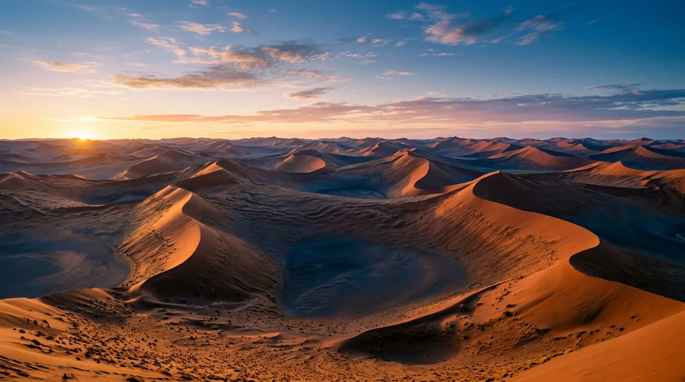
The Wahiba Sands — officially the Sharqiya Sands since the government renamed them, though nobody uses the new name — are a 12,500 square kilometre sand desert in eastern Oman. The dunes run roughly north-south in parallel ridges, rising to heights of 15-25 metres in the northern section and flattening to lower, wider formations in the south. Between the ridges are hard-pan corridors of compacted sand and gravel that provide faster, easier driving — the respite between the challenges. The classic crossing runs 80 km from Al Wasil on the northern edge to the southern settlements near Al Kamil, traversing the dune ridges at right angles and using the corridors as transit routes.
This is expert-level sand driving. Not moderate, not advanced — expert. The dunes are steep, the sand is soft, and there is no road, no track, and no marker to follow. Navigation is by GPS, by dune topography (the corridors between ridges are visible from the dune crests), and by the accumulated experience of knowing where soft sand lurks. We got stuck four times during the crossing. A competent driver with desert experience would get stuck twice. A driver without desert experience should not attempt this route without a guide or a convoy.
Route overview
The crossing we drove runs approximately north to south, which follows the natural grain of the dune ridges. East-west crossings are possible but significantly harder — you spend more time climbing and descending ridges and less time using the corridors between them.
| Section | Distance | Terrain | Difficulty | Time |
|---|---|---|---|---|
| Al Wasil to dune field edge | ~10 km | Gravel, firming sand | Easy | 20 min |
| Northern dune zone | ~25 km | Dune ridges, soft sand, corridors | Expert | 3-4 hours |
| Central hard-pan flats | ~15 km | Hard compacted sand | Moderate | 45 min |
| Southern dune zone | ~20 km | Lower dunes, mixed sand | Challenging | 2-3 hours |
| Southern edge to tarmac | ~10 km | Firming sand, gravel | Easy | 20 min |
Total: approximately 80 km, 7-10 hours of driving. This can be done in a long day (enter at dawn, exit at dusk) or, more comfortably, in two days with a Bedouin camp overnight at the central hard-pan flats.
Preparation
Vehicle
A 4x4 with low-range transfer case is mandatory. No exceptions and no workarounds. The dune crossings require first gear low-range for the climbs and engine braking for the descents. A vehicle without low-range will overheat the transmission on the sustained climbs and overheat the brakes on the descents.
Minimum specs: Low-range transfer case, 200mm+ ground clearance, all-terrain tires (not road tires — the tread pattern matters in sand), functional 4WD system with both front and rear axle engagement.
Recommended vehicles: Toyota Land Cruiser (any generation from the 100 series onward), Nissan Patrol Y61 or Y62, Mitsubishi Pajero/Shogun. These are the standard Omani desert vehicles and they are proven in this terrain.
Marginal vehicles: Suzuki Jimny (low-range capable but the engine is small and the vehicle is light — it can be pushed off line by its own momentum on dune crests). Dacia Duster 4x4 (no low-range — not recommended).
Tire pressure protocol
Tire pressure is the single most important variable in sand driving. The relationship between pressure and performance in sand is not linear — it is more like a cliff. At normal road pressure (32-35 PSI), your tires cut into the sand and you stop within metres. At 12-15 PSI, the same tires float on the surface and you can drive at 25 km/h across sand that would have buried you at higher pressure.
| Terrain | Pressure (PSI) | Notes |
|---|---|---|
| Approaching on tarmac | 32-35 | Normal road pressure |
| Gravel approach to dune field | 22-25 | Slight deflation for comfort |
| Hard-pan corridors | 18-20 | Moderate deflation |
| Dune ridges (soft sand) | 12-15 | Full deflation for flotation |
| Deep sand recovery | 10-12 | Emergency only, walking speed |
| Returning to tarmac | 32-35 | Re-inflate before driving on road |
Critical rule: Deflate before entering the sand, not after you get stuck. We see this mistake repeatedly — drivers enter the dune field at road pressure, get stuck on the first soft section, and then deflate. By that point, the vehicle is already embedded and deflation alone will not extract it. Deflate at the edge of the dune field, on firm ground, where you can set the pressure carefully and test it.
Carry a compressor. A 12V compressor rated for truck tires (not the tiny ones sold for bicycle tires). You will inflate and deflate multiple times, and driving on tarmac at 12 PSI will destroy your tires and potentially cause a blowout at speed.
Recovery equipment
| Item | Required | We used it? |
|---|---|---|
| Recovery boards (pair) | Yes | Yes, four times |
| Tire deflator (screw-on type) | Yes | Yes, multiple times |
| 12V compressor (150+ PSI rated) | Yes | Yes, multiple times |
| Tow strap (5-tonne, 3m) | Yes | No (solo vehicle) |
| Folding shovel | Yes | Yes, twice |
| Snatch strap (kinetic, 8-tonne) | Recommended | No (solo vehicle) |
| Hi-lift jack | Optional | No (recovery boards were sufficient) |
If you are driving solo: Carry all of the above. If you get stuck beyond recovery board depth with no one to pull you out, your options are limited to digging and patience. A satellite communicator (InReach, SPOT, or similar) is strongly recommended — there is no mobile coverage in the Wahiba Sands.
If you are driving in convoy: Two vehicles can recover each other using a snatch strap for most situations. This is the recommended approach for first-time Wahiba drivers.
Navigation
There are no tracks, no markers, and no roads in the Wahiba Sands. Navigation is by GPS using pre-loaded waypoints or track files.
GPS tracks: The Bedouin camp operators and some tourism offices in Al Wasil and Ibra can provide GPS waypoint files (GPX format) for crossing routes. These are not universally available — ask at your accommodation the night before. Alternatively, several Oman 4x4 forums publish track files that members have recorded. Load these into a dedicated GPS unit or a phone running OsmAnd.
Topographic navigation: If your GPS fails (batteries, water damage, dropped in sand), you can navigate by dune topography. The ridges run roughly north-south. The corridors between them run north-south as well. If you are heading south, keep the sun on your left in the morning and on your right in the afternoon. Look for the corridors from the dune crests — they are visible as flat, lighter-coloured strips between the orange ridges.
This is backup navigation only. Carry a GPS.
Fuel and water
Fuel: There is no fuel in the Wahiba Sands. The last fuel is Al Wasil on the north side or Al Kamil/Ibra on the east. The crossing itself is only 80 km, but sand driving consumes fuel at roughly 25-30L/100km — double or more of normal highway consumption. Budget 20-24 litres for the crossing. With a full 90-litre tank, most 4x4s will complete the crossing with ample reserve. Carry a 10L jerry can regardless.
Water: Carry 10 litres per person per day. The Wahiba is hot (30-38 degrees even in the cool season), dry, and the physical effort of recovery work (digging, placing boards, pushing) accelerates dehydration. The Bedouin camps have water, but you should not depend on reaching one at a specific time.
The crossing
Entry: Al Wasil (22.3333° N, 58.7500° E)
Al Wasil is a small town on the northern edge of the Wahiba Sands, about 200 km southeast of Muscat via Highway 23 and Route 32. The town has a fuel station (fill up here, completely), a few shops, and a cluster of tour operators offering guided desert experiences (camel rides, camp stays, guided 4x4 tours).
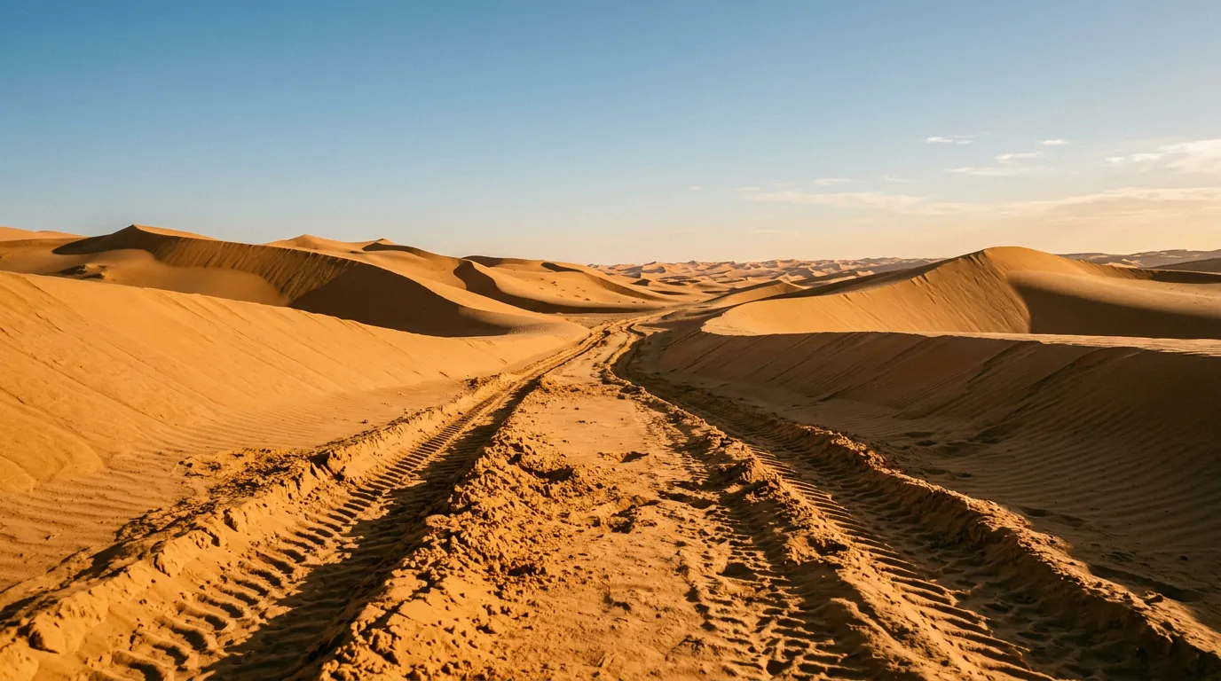
From Al Wasil, a gravel track leads south into the dune field. The transition from firm ground to sand is gradual — the gravel thins, the sand deepens, and within about 5 km you are driving on pure sand. This is where you deflate your tires. Stop on the last firm ground, set your pressure to 15 PSI (or lower if the sand ahead looks particularly soft), and confirm your GPS is working.
Northern dune zone (25 km)
The northern section has the tallest and steepest dunes in the Wahiba. The ridges here rise 15-25 metres and are oriented roughly east-west (perpendicular to your direction of travel), which means you are climbing and descending continuously. Between the ridges, hard-pan corridors run north-south for distances of 500 metres to 2 km, providing brief relief before the next climb.
Dune crossing technique:
The approach. Study the dune from a distance. Look for the lowest point on the ridge (the “saddle”) — this is where the sand is usually firmest and the climb shortest. Approach straight on, perpendicular to the ridge.
The climb. Build momentum on the hard pan and hit the base of the dune at 25-30 km/h in second gear low-range. Maintain steady throttle. Do not let the engine speed drop — if the wheels slow down, you lose momentum, and momentum is the only thing keeping you on the surface. If the vehicle slows to walking pace before you reach the crest, do not try to force it. Stop, reverse down (straight, never at an angle), and try again with more speed or a different line.
The crest. As you reach the top, ease off the throttle. The crest is a blind transition — you cannot see the descent angle until you are on it. Rolling over the crest at speed can result in the vehicle becoming briefly airborne if the far side is steeper than expected. Approach the crest at 15-20 km/h and let gravity take over.
The descent. Let the vehicle slide down under engine braking. Do not brake hard — the wheels will lock in the sand and the vehicle will slide uncontrolled. Gentle brake inputs to control speed, steering straight down the face. If the rear end starts to swing, steer into the slide (counter-steer) as you would on ice.
The recovery. If you get stuck on a dune face (usually on the climb, where the sand is softest near the crest), stop. Do not spin the wheels — this digs the vehicle deeper. Place recovery boards in front of the drive wheels. If the vehicle is angled, dig out the downhill wheels to level it before attempting to move. Reverse onto the boards, build a short platform of compacted sand, then attempt the climb again.
Central hard-pan flats (15 km)
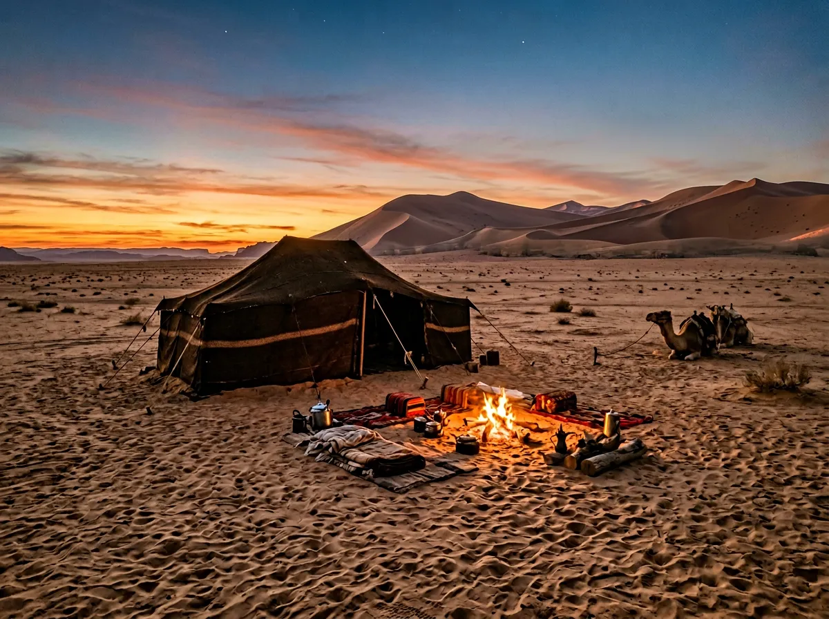
At approximately the midpoint of the crossing, the dunes give way to a broad, flat expanse of hard compacted sand and gravel. This is the best driving of the route — the surface is firm, the speed picks up to 40-50 km/h, and the horizon extends in every direction. The hard pan is also where the Bedouin camps are located.
Bedouin camps:
Several Bedouin families operate desert camps on the hard-pan flats. These range from basic (mattress under a shelter, communal fire, coffee) to moderately comfortable (walled tent, bedding, dinner and breakfast included). Prices range from 15 to 25 OMR per person per night including the evening meal, which is typically grilled meat, rice, and dates.
Booking is informal. Some camps have WhatsApp numbers that you can call (if you managed to get a number before losing signal). Others are simply found by driving to the hard-pan area and looking for tent clusters. The camps move seasonally, so GPS coordinates from last year may not be accurate.
We stayed at a camp run by a Bedouin family who appeared to have been in the same location for several generations — the camp infrastructure (permanent stone fire pit, water storage, solar panel) suggested permanence. Dinner was goat and rice cooked over the fire. The night sky was the clearest we have seen outside the Namib Desert — the Milky Way was visible as a physical structure rather than a vague glow.
Cost: 20 OMR per person including dinner and breakfast.
Southern dune zone (20 km)
South of the hard-pan flats, the dunes resume but at lower heights — 5-10 metres rather than the 15-25 metres of the northern zone. The sand is a lighter colour (yellow-white rather than orange) and generally firmer. The driving is less demanding than the northern section but still requires sand technique — the dunes are lower but the soft sections are sneaky, appearing where the sand looks identical to the firm sections on either side.
The southern zone transitions gradually to flat sabkha — salt flat — near the southern edge of the Wahiba. The sabkha surface is hard and fast when dry but becomes treacherous when wet — the crust can support a vehicle’s weight until it suddenly does not, at which point the vehicle drops through into soft, salty mud that is harder to escape than sand. Stay on established tracks in the sabkha zone.
Exit: Southern settlements
The southern edge of the Wahiba is marked by small settlements and a paved road connecting Al Kamil to the coastal towns. The transition from sand to firm ground is the mirror of the entry — sand thins, gravel appears, and suddenly you are on tarmac.
Re-inflate your tires immediately. We cannot emphasize this enough. Driving on paved roads at 12-15 PSI will overheat the tire sidewalls, deform the bead seal, and potentially cause a blowout. Pull over at the first firm spot, connect the compressor, and pump back to road pressure (32-35 PSI). This takes about 20 minutes for all four tires with a standard 12V compressor.
Sand driving: a summary of lessons
Over the course of the crossing, we accumulated a working understanding of sand driving that can be condensed to five principles:
1. Momentum is survival. A moving vehicle stays on the surface. A stationary vehicle sinks. Everything in sand driving is about maintaining momentum — the approach speed, the throttle management, the line choice, even the gear selection. If you are moving, you are driving. If you are not moving, you are digging.
2. Pressure is everything. The difference between 30 PSI and 13 PSI in soft sand is the difference between stuck and driving. Deflate before the sand, not in the sand.
3. Straight lines up and down. Climb dunes perpendicular to the ridge. Descend straight down. Crossing a dune at an angle is a recipe for rollover — the vehicle leans into the slope, the uphill wheels lose traction, and gravity does the rest. If you need to change direction, do it on the flat between dunes.
4. Read the sand. Colour, texture, and wind patterns indicate firmness. Dark, rippled sand is usually firm. Smooth, light sand is usually soft. Sand in the lee of dunes (the downwind side) is softer than sand on the windward side. Tire tracks from other vehicles indicate driveable routes — if someone else made it through, the surface supported a vehicle.
5. Do not panic when stuck. Getting stuck is normal. It is not failure — it is sand driving. Stop the wheels. Assess the situation. Dig, board, or deflate as needed. The sand is not going anywhere, and neither are you until you deal with it calmly.
Combining with other routes
From the southern edge of the Wahiba, the road east leads to Al Kamil and then to Sur (approximately 100 km, paved), which connects to the Wadi Bani Khalid to Sur route. From Al Wasil on the northern edge, Ibra and Wadi Bani Khalid are about 50 km west. Jebel Akhdar is approximately 200 km northwest via Nizwa.
For comparable sand driving in other countries, the Wadi Rum desert tracks in Jordan offer sand in a more contained environment, and the Merzouga to Zagora piste in Morocco provides a longer desert crossing with more varied terrain.
The honest summary
The Wahiba Sands crossing is the most technically demanding route in our Oman collection and one of the most demanding we have documented anywhere. It is not a drive you take for the scenery (though the dune light at sunrise and sunset is exceptional). It is a drive you take for the driving — the specific, absorbing, problem-solving concentration of getting a vehicle across terrain that would prefer you stayed home.
We came out the southern side with four recovery stories, a deep respect for 13 PSI, and sand in places where sand has no business being. The Bedouin camp under the stars at the midpoint made all of it worthwhile.
Do not attempt it alone on your first time. Do not attempt it without recovery gear. Do deflate your tires.